
File:Port Perry train station 1912.jpg
No higher resolution available.
Port_Perry_train_station_1912.jpg (792 × 479 pixels, file size: 84 KB, MIME type: image/jpeg)
| This is a file from the Wikimedia Commons. Information from its description page there is shown below. Commons is a freely licensed media file repository. You can help. |
Summary
| Camera location | | View this and other nearby images on: OpenStreetMap |
|---|
| Description |
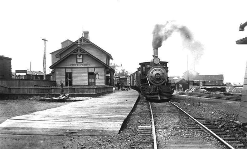
English: One of the best known images of the Port Perry train station, looking almost due north some time in 1912. A train can be seen approaching the camera's location on the former mainline of the Port Whitby and Port Perry Railway. Visible just to the right is the new mainline, which leads past the town and north-east to Lindsay. The grain elevator can be seen rising above the station, just to the left. Lake Scugog is just visible on the extreme right. |
| Date | |
| Source | http://www.scugogheritage.com/cgi-bin/emAlbum/emAlbum.cgi?cmd=show_image&path=1910-1919&img=19&tn=1 |
| Author | Unknown, very old PD image |
Licensing
This Canadian work is in the public domain in Canada because its copyright has expired due to one of the following:
it was not subject to Crown copyright, and
|
 |
File history
Click on a date/time to view the file as it appeared at that time.
| Date/Time | Thumbnail | Dimensions | User | Comment | |
|---|---|---|---|---|---|
| current | 17:42, 22 January 2012 | | 792 × 479 (84 KB) | Maury Markowitz |
File usage
The following pages on the English Wikipedia use this file (pages on other projects are not listed):