
File:Map of USA AK full.svg

Size of this PNG preview of this SVG file: 800 × 560 pixels. Other resolutions: 320 × 224 pixels | 640 × 448 pixels | 1,024 × 717 pixels | 1,280 × 896 pixels | 2,560 × 1,792 pixels.
Original file (SVG file, nominally 800 × 560 pixels, file size: 376 KB)
| This is a file from the Wikimedia Commons. Information from its description page there is shown below. Commons is a freely licensed media file repository. You can help. |
Summary
| Description |
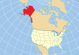
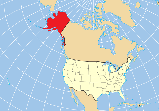
English: Map of the US state of Alaska relative to the rest of the country using a constant projection. A vector reproduction of Map of USA AK full.png based on the public domain location map from [1]. |
| Date | |
| Source | Own work |
| Author | skew-t |
Licensing
| I, the copyright holder of this work, release this work into the public domain. This applies worldwide. In some countries this may not be legally possible; if so: I grant anyone the right to use this work for any purpose, without any conditions, unless such conditions are required by law. |
File history
Click on a date/time to view the file as it appeared at that time.
| Date/Time | Thumbnail | Dimensions | User | Comment | |
|---|---|---|---|---|---|
| current | 20:54, 17 December 2012 | | 800 × 560 (376 KB) | Ras67 | black frame removed, basic size adjusted |
| 08:56, 26 May 2010 |  | 159 × 112 (377 KB) | Skew-t | {{Information |Description={{en|1=Map of the US state of Alaska relative to the rest of the country using a constant projection. A vector reproduction of Map of USA AK full.png based on the public domain location map from |
File usage
The following pages on the English Wikipedia use this file (pages on other projects are not listed):
Global file usage
The following other wikis use this file:
- Usage on af.wikipedia.org
- Usage on bcl.wikipedia.org
- Usage on br.wikipedia.org
- Usage on ca.wikipedia.org
- Usage on es.wikipedia.org
- Nome
- Hope (Alaska)
- North Pole
- Teller (Alaska)
- Akutan (Alaska)
- Cold Bay
- False Pass
- King Cove (Alaska)
- Sand Point (Alaska)
- Nelson Lagoon
- Belkofski
- Ikatan (Alaska)
- Morzhovoi
- Unga (Alaska)
- King Salmon
- Naknek
- South Naknek
- Anderson (Alaska)
- Cantwell (Alaska)
- Ferry (Alaska)
- Healy (Alaska)
- McKinley Park (Alaska)
- Clear (Alaska)
- Kantishna
- Suntrana (Alaska)
- College (Alaska)
- Base de la Fuerza Aérea Eielson
- Ester (Alaska)
- Fox (Alaska)
- Harding-Birch Lakes
- Moose Creek
- Pleasant Valley (Alaska)
- Salcha
- Two Rivers (Alaska)
- Chatanika (Alaska)
- Chena Hot Springs
- Portal:Alaska
- Portal:Alaska/Titular
- Covenant Life
- Haines (Alaska)
- Lutak
- Mosquito Lake (Alaska)
- Mud Bay (Alaska)
- Kachemak (Alaska)
- Seldovia (Alaska)
- Seward (Alaska)
View more global usage of this file.