
File:Kirkby Town Centre - geograph.org.uk - 122465.jpg
No higher resolution available.
Kirkby_Town_Centre_-_geograph.org.uk_-_122465.jpg (640 × 480 pixels, file size: 60 KB, MIME type: image/jpeg)
| This is a file from the Wikimedia Commons. Information from its description page there is shown below. Commons is a freely licensed media file repository. You can help. |
Summary
| Description |
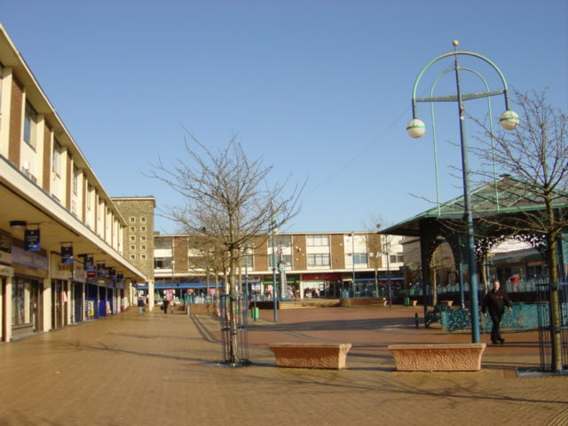
English: Kirkby centre. Looking north from Newtown Gardens.
The "Newtown" (remember Z cars?) of Kirkby owes its being to the closure of the Royal Ordnance Factory in 1946 when the Government suggested to Liverpool City Council that making use of some of the thousand buildings and creating a large trading/industrial estate would provide jobs for redundant workers and the demobbed. The trading estate steadily expanded through the 1950s and 1960s to become one of the largest in the country, at its peak in 1971, the estate employed over 26,000 people. A model town of 10,000 houses was constructed, mainly as an overspill for Liverpool, on what was once agricultural land and the modest population of 3,000 expanded to 50,000 by 1961. New facilities to cater for the growing population included a variety of shops, banks and business premises, a library and a market, probably the only surviving outdoor market on Merseyside. |
| Date | |
| Source | From geograph.org.uk |
| Author | Sue Adair |
| Attribution (required by the license) | Sue Adair / Kirkby Town Centre / |
| Object location | | View this and other nearby images on: OpenStreetMap |
|---|
_&language=en)
Licensing

|
This image was taken from the Geograph project collection. See this photograph's page on the Geograph website for the photographer's contact details. The copyright on this image is owned by Sue Adair and is licensed for reuse under the Creative Commons Attribution-ShareAlike 2.0 license.
|
This file is licensed under the Creative Commons Attribution-Share Alike 2.0 Generic license.
Attribution: Sue Adair
- You are free:
- to share – to copy, distribute and transmit the work
- to remix – to adapt the work
- Under the following conditions:
- attribution – You must give appropriate credit, provide a link to the license, and indicate if changes were made. You may do so in any reasonable manner, but not in any way that suggests the licensor endorses you or your use.
- share alike – If you remix, transform, or build upon the material, you must distribute your contributions under the same or compatible license as the original.
- Remove redundant categories and try to put this image in the most specific category/categories
- Remove this template
- The location categories are based on information from this geonames tool and this OpenStreetMap tool combined with a database. You can also have a look at this tool from mysociety.
- The topic category from Geograph was Kirkby centre (find similar images centre at Geograph)
File history
Click on a date/time to view the file as it appeared at that time.
| Date/Time | Thumbnail | Dimensions | User | Comment | |
|---|---|---|---|---|---|
| current | 03:31, 31 January 2010 | | 640 × 480 (60 KB) | GeographBot | == {{int:filedesc}} == {{Information |description={{en|1=Kirkby Town Centre. Looking north from Newtown Gardens to Kirkby town centre. The "Newtown" (remember Z cars?) of Kirkby owes its being to the closure of the Royal Ordnance Factory in 1946 when the |
File usage
The following pages on the English Wikipedia use this file (pages on other projects are not listed):
Global file usage
The following other wikis use this file:
- Usage on ar.wikipedia.org
- Usage on be.wikipedia.org
- Usage on ceb.wikipedia.org
- Usage on cy.wikipedia.org
- Usage on de.wikipedia.org
- Usage on es.wikipedia.org
- Usage on it.wikipedia.org
- Usage on lld.wikipedia.org
- Usage on pl.wikipedia.org
- Usage on ro.wikipedia.org
- Usage on ru.wikipedia.org
- Usage on sv.wikipedia.org
- Usage on www.wikidata.org