
File:Grunnavík.jpg

Size of this preview: 800 × 315 pixels. Other resolutions: 320 × 126 pixels | 640 × 252 pixels | 1,878 × 739 pixels.
Original file (1,878 × 739 pixels, file size: 595 KB, MIME type: image/jpeg)
| This is a file from the Wikimedia Commons. Information from its description page there is shown below. Commons is a freely licensed media file repository. You can help. |
Summary
| Description |
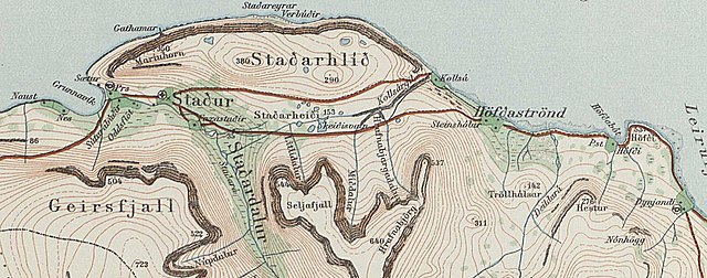
English: Grunnavík |
| Date | |
| Source | https://myndir.islandskort.is/map/Uppdrattur_Islands___1_1_________1921_1944_38/21__Drangajokull_751/1016/2012-10-16-12-32-24.jpg |
| Author | Geodetic Institute Copenahagen & Reykjavík 1934 |
Licensing
the copyright has certainly expired

|
The contents of this file is, in either full extent or partially, based on open public geographic data from the Danish Geodata Agency:
|
File history
Click on a date/time to view the file as it appeared at that time.
| Date/Time | Thumbnail | Dimensions | User | Comment | |
|---|---|---|---|---|---|
| current | 00:40, 5 April 2021 | 1,878 × 739 (595 KB) | Xypete | Uploaded a work by Geodetic Institute Copenahagen & Reykjavík 1934 from https://myndir.islandskort.is/map/Uppdrattur_Islands___1_1_________1921_1944_38/21__Drangajokull_751/1016/2012-10-16-12-32-24.jpg with UploadWizard |
File usage
The following pages on the English Wikipedia use this file (pages on other projects are not listed):
Global file usage
The following other wikis use this file:
- Usage on is.wikipedia.org