
File:Golan Heights and vicinity, October 1994.png
Size of this preview: 473 × 600 pixels. Other resolutions: 189 × 240 pixels | 379 × 480 pixels | 606 × 768 pixels | 808 × 1,024 pixels | 1,882 × 2,386 pixels.
Original file (1,882 × 2,386 pixels, file size: 4.69 MB, MIME type: image/png)
| This is a file from the Wikimedia Commons. Information from its description page there is shown below. Commons is a freely licensed media file repository. You can help. |
Summary
| Description |
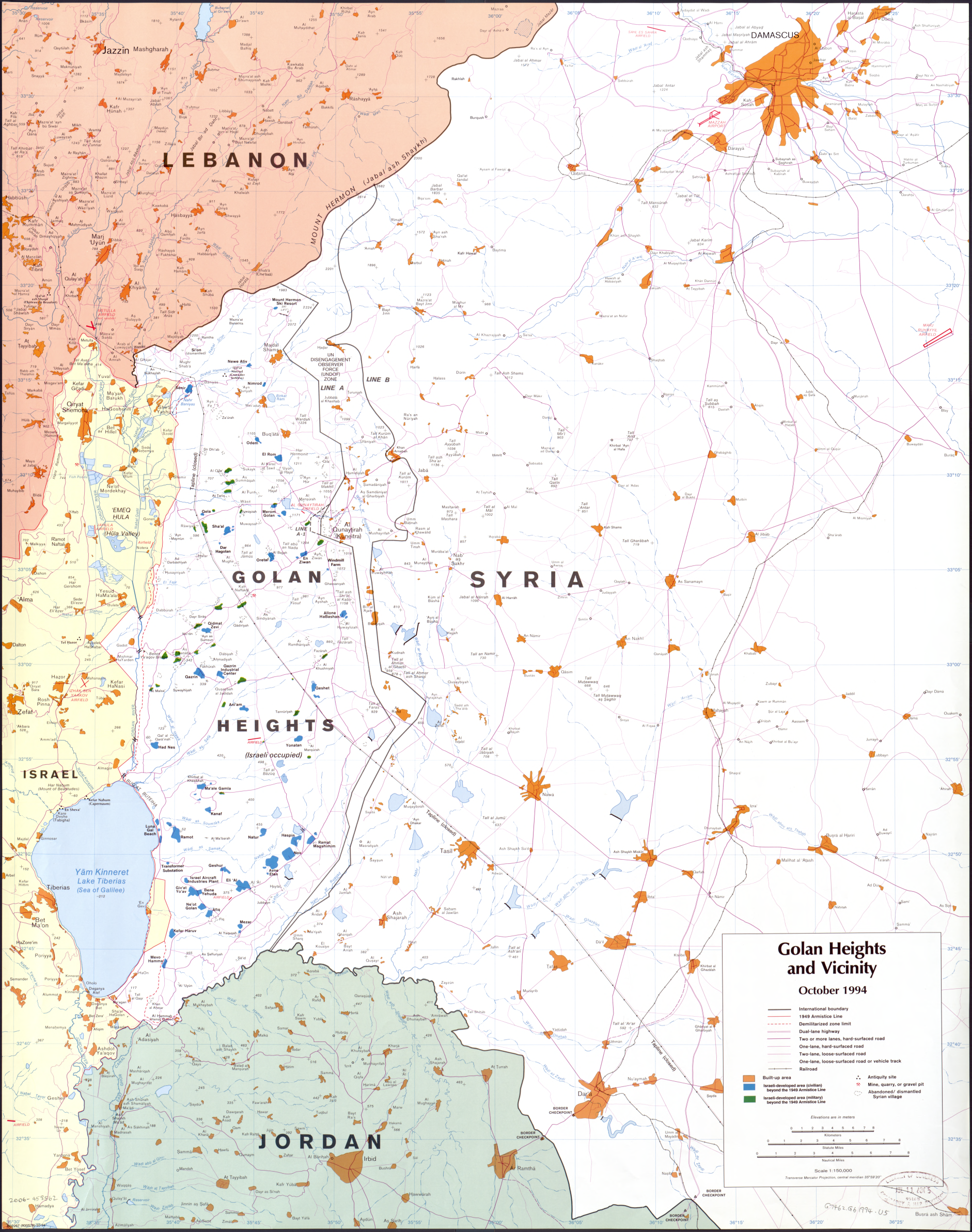
English: Map of Golan Heights and vicinity : October 1994. |
||
| Date | |||
| Source |
Library of Congress Geography and Map Division
|
||
| Author | Central Intelligence Agency | ||
| Other versions |

.png)
- NOTES
Relief shown by spot heights.
"802267 (R00578) 10-94."
Scale 1:150,000 ; transverse Mercator proj., central meridian 35059'20" (E 35030'--E 36025'/N 33030'--N 32035').
Licensing
| This image is a work of a Central Intelligence Agency employee, taken or made as part of that person's official duties. As a Work of the United States Government, this image or media is in the public domain in the United States.
|

|
File history
Click on a date/time to view the file as it appeared at that time.
| Date/Time | Thumbnail | Dimensions | User | Comment | |
|---|---|---|---|---|---|
| current | 16:20, 8 October 2010 | | 1,882 × 2,386 (4.69 MB) | AgadaUrbanit | Reduced resolution from original 7529 x 9542 Pixels (71.84 MPixels) to 1882 x 2386 Pixels (4.49 MPixels) |
| 12:37, 8 October 2010 |  | 7,529 × 9,542 (57.06 MB) | AgadaUrbanit | Golan Heights and vicinity : October 1994. United States. Central Intelligence Agency. CREATED/PUBLISHED [Washington, D.C. : Central Intelligence Agency, 1994] NOTES Relief shown by spot heights. "802267 (R00578) 10-94." Scale 1:150,000 ; transver |
File usage
No pages on the English Wikipedia use this file (pages on other projects are not listed).