
File:Gardens OSM map.svg

Size of this PNG preview of this SVG file: 800 × 595 pixels. Other resolutions: 320 × 238 pixels | 640 × 476 pixels | 1,024 × 762 pixels | 1,280 × 953 pixels | 2,560 × 1,905 pixels | 1,126 × 838 pixels.
Original file (SVG file, nominally 1,126 × 838 pixels, file size: 6.42 MB)
| This is a file from the Wikimedia Commons. Information from its description page there is shown below. Commons is a freely licensed media file repository. You can help. |
| Description |
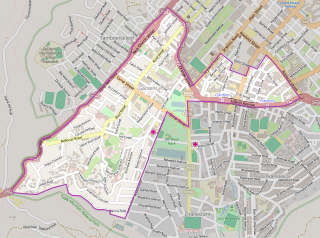
This map of Gardens was created from OpenStreetMap project data, collected by the community. This map may be incomplete, and may contain errors. Don't rely solely on it for navigation. |
|||||||||
| Date | (see file history) | |||||||||
| Source | openstreetmap.org | |||||||||
| Creator |
OpenStreetMap contributors |
|||||||||
| Permission (Reusing this file) |
OpenStreetMap data is available under the Open Database License (details). Map tiles are licensed under the Creative Commons Attribution-ShareAlike 2.0 license (CC-BY-SA 2.0).
This file is licensed under the Creative Commons Attribution-Share Alike 2.0 Generic license.
|
|||||||||
| Geotemporal data | ||||||||||
| Bounding box |
|
|||||||||
| Georeferencing | If inappropriate please set warp_status = skip to hide. | |||||||||
| Other versions | File:Gardens OSM map small.svg | |||||||||
File history
Click on a date/time to view the file as it appeared at that time.
| Date/Time | Thumbnail | Dimensions | User | Comment | |
|---|---|---|---|---|---|
| current | 22:01, 12 October 2015 | | 1,126 × 838 (6.42 MB) | Htonl | Update w/ boundary |
| 19:11, 2 July 2010 |  | 1,126 × 838 (5.11 MB) | Htonl | update | |
| 23:56, 9 October 2009 |  | 1,111 × 819 (5.15 MB) | Htonl | {{OpenStreetMap |location=Gardens, Cape Town |other_versions=File:Gardens OSM map small.svg Category:Maps of Cape Town suburbs}} |
File usage
The following pages on the English Wikipedia use this file (pages on other projects are not listed):
Global file usage
The following other wikis use this file:
- Usage on af.wikipedia.org
- Usage on fr.wikipedia.org