
File:Croftburn Farmhouse.jpg

Size of this preview: 800 × 532 pixels. Other resolutions: 320 × 213 pixels | 640 × 426 pixels | 1,024 × 681 pixels | 1,280 × 851 pixels | 2,560 × 1,702 pixels | 6,016 × 4,000 pixels.
Original file (6,016 × 4,000 pixels, file size: 9.68 MB, MIME type: image/jpeg)
| This is a file from the Wikimedia Commons. Information from its description page there is shown below. Commons is a freely licensed media file repository. You can help. |
|
This is an image of a place or building that is listed on the National Register of Historic Places in the United States of America. Its reference number is 01000153. |
| Camera location | | View this and other nearby images on: OpenStreetMap |
|---|
| Description |
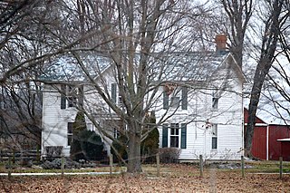
English: Through-the-trees view of the Croftburn Farmhouse, located along State Route 3 southeast of Culpeper in Culpeper County, Virginia, United States. The farmstead is listed on the National Register of Historic Places. |
||
| Date | Taken on 18 January 2020 | ||
| Source | Self-photographed | ||
| Author | Nyttend | ||
| Permission (Reusing this file) |
|
||
| Other versions | None |
File history
Click on a date/time to view the file as it appeared at that time.
| Date/Time | Thumbnail | Dimensions | User | Comment | |
|---|---|---|---|---|---|
| current | 05:37, 22 June 2022 | | 6,016 × 4,000 (9.68 MB) | WikiPedant | adjusted levels; sharpened aggressively |
| 05:45, 29 February 2020 |  | 6,016 × 4,000 (6.33 MB) | Nyttend |
File usage
The following pages on the English Wikipedia use this file (pages on other projects are not listed):
Global file usage
The following other wikis use this file:
- Usage on www.wikidata.org