
File:Colony Bog - geograph.org.uk - 59617.jpg
No higher resolution available.
Colony_Bog_-_geograph.org.uk_-_59617.jpg (640 × 427 pixels, file size: 127 KB, MIME type: image/jpeg)
| This is a file from the Wikimedia Commons. Information from its description page there is shown below. Commons is a freely licensed media file repository. You can help. |
Summary
| Description |
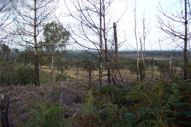
English: Colony Bog. Colony Bog is in the very heart of the Pirbright Ranges danger area. I have now approached it from three sides with varying degrees of success. This picture is taken from Chobham Ridges looking ENE into the square. The line of trees in the middle distance is a belt of pines that follow the Trulley Brook which flows out of the bog. This picture, taken from Chobham Ridges through the impenetrable boundary fence of the Range Danger Area (see SU9159 : Keep Out!), shows part of the square that is within the danger area. The view is of the slope of Loveland's Hill, looking ESE. |
| Date | |
| Source | From geograph.org.uk |
| Author | Ron Strutt |
| Attribution (required by the license) | Ron Strutt / Colony Bog / |
| Camera location | | View this and other nearby images on: OpenStreetMap |
|---|
_region:GB-ENG_&language=en)
Licensing

|
This image was taken from the Geograph project collection. See this photograph's page on the Geograph website for the photographer's contact details. The copyright on this image is owned by Ron Strutt and is licensed for reuse under the Creative Commons Attribution-ShareAlike 2.0 license.
|
This file is licensed under the Creative Commons Attribution-Share Alike 2.0 Generic license.
Attribution: Ron Strutt
- You are free:
- to share – to copy, distribute and transmit the work
- to remix – to adapt the work
- Under the following conditions:
- attribution – You must give appropriate credit, provide a link to the license, and indicate if changes were made. You may do so in any reasonable manner, but not in any way that suggests the licensor endorses you or your use.
- share alike – If you remix, transform, or build upon the material, you must distribute your contributions under the same or compatible license as the original.
File history
Click on a date/time to view the file as it appeared at that time.
| Date/Time | Thumbnail | Dimensions | User | Comment | |
|---|---|---|---|---|---|
| current | 14:00, 30 January 2010 | | 640 × 427 (127 KB) | GeographBot | == {{int:filedesc}} == {{Information |description={{en|1=Colony Bog. Colony Bog is in the very heart of the Pirbright Ranges danger area. I have now approached it from three sides with varying degrees of success. This picture is taken from Chobham Ridges |
File usage
The following pages on the English Wikipedia use this file (pages on other projects are not listed):