
File:Chester-le-Street, Ropery Lane Cricket Ground (geograph 2900006).jpg
Size of this preview: 800 × 595 pixels. Other resolutions: 320 × 238 pixels | 640 × 476 pixels | 1,024 × 761 pixels.
Original file (1,024 × 761 pixels, file size: 822 KB, MIME type: image/jpeg)
| This is a file from the Wikimedia Commons. Information from its description page there is shown below. Commons is a freely licensed media file repository. You can help. |
.jpg)
Summary
| Description |
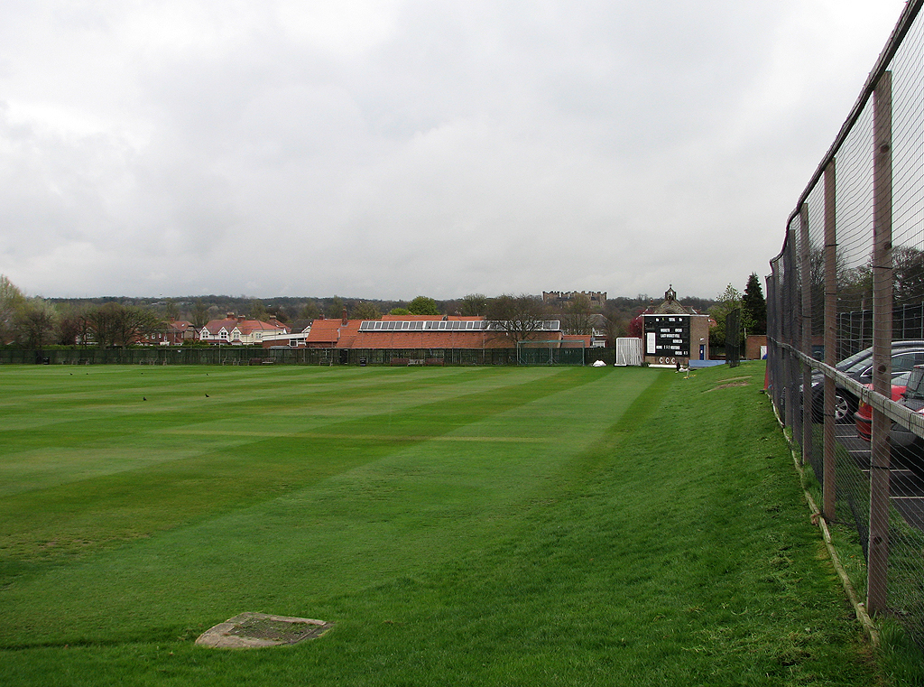
English: Chester-le-Street: Ropery Lane Cricket Ground
A view along the boundary towards the scoreboard, with the bellcote of St Cuthbert's RC Church above it and Lumley Castle on the skyline to the left. Chester-le-Street CC plays in the North Eastern Premier League. One County Championship match was played here, in 1993, Durham's second season as a first-class county: Durham (308 and 164) lost to Nottinghamshire (629) by an innings and 157 runs. |
| Date | |
| Source | https://www.geograph.org.uk/photo/2900006 |
| Author | John Sutton |
| Attribution (required by the license) | John Sutton / Chester-le-Street: Ropery Lane Cricket Ground / |
| Camera location | | View this and other nearby images on: OpenStreetMap |
|---|
.jpg¶ms=054.851830_N_-001.571600_E_globe:Earth_type:camera_source:geograph-osgb36(NZ27605086)_region:GB-GBN_heading:90.00&language=en)
| Object location | | View this and other nearby images on: OpenStreetMap |
|---|
.jpg¶ms=054.851830_N_-001.570500_E_globe:Earth_class:object_type:object_source:geograph-osgb36(NZ27675086)_region:GB-GBN_heading:90.00&language=en)
Licensing

|
This image was taken from the Geograph project collection. See this photograph's page on the Geograph website for the photographer's contact details. The copyright on this image is owned by John Sutton and is licensed for reuse under the Creative Commons Attribution-ShareAlike 2.0 license.
|
This file is licensed under the Creative Commons Attribution-Share Alike 2.0 Generic license.
Attribution: John Sutton
- You are free:
- to share – to copy, distribute and transmit the work
- to remix – to adapt the work
- Under the following conditions:
- attribution – You must give appropriate credit, provide a link to the license, and indicate if changes were made. You may do so in any reasonable manner, but not in any way that suggests the licensor endorses you or your use.
- share alike – If you remix, transform, or build upon the material, you must distribute your contributions under the same or compatible license as the original.
File history
Click on a date/time to view the file as it appeared at that time.
| Date/Time | Thumbnail | Dimensions | User | Comment | |
|---|---|---|---|---|---|
| current | 21:08, 10 December 2018 | | 1,024 × 761 (822 KB) | AssociateAffiliate | User created page with UploadWizard |
File usage
The following pages on the English Wikipedia use this file (pages on other projects are not listed):
Global file usage
The following other wikis use this file:
- Usage on www.wikidata.org
.jpg)