
File:CTO201311-C36-3 Matsugabo Dam.jpg

Size of this preview: 800 × 451 pixels. Other resolutions: 320 × 180 pixels | 640 × 361 pixels | 1,024 × 577 pixels | 1,280 × 721 pixels | 2,560 × 1,443 pixels | 4,780 × 2,694 pixels.
Original file (4,780 × 2,694 pixels, file size: 3.02 MB, MIME type: image/jpeg)
| This is a file from the Wikimedia Commons. Information from its description page there is shown below. Commons is a freely licensed media file repository. You can help. |
Summary
| Description |
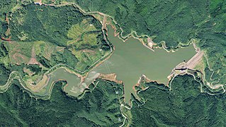
English: Matsugabo Dam.
日本語: 松ヶ房ダム。 |
| Date | Taken on 17 September 2013 |
| Source | http://mapps.gsi.go.jp/maplibSearch.do?specificationId=1576193 |
| Author |
Geospatial Information Authority of Japan Retouch: Qurren (talk) |
| Camera location | | View this and other nearby images on: OpenStreetMap |
|---|
Licensing

|
This work is licensed under the Government of Japan Standard Terms of Use (Ver.2.0). The Terms of Use are compatible with the Creative Commons Attribution License 4.0 International. For the terms of use of this work, see this license page.
|
This file is licensed under the Creative Commons Attribution 4.0 International license.
Attribution: 国土地理院 (Geospatial Information Authority of Japan)
- You are free:
- to share – to copy, distribute and transmit the work
- to remix – to adapt the work
- Under the following conditions:
- attribution – You must give appropriate credit, provide a link to the license, and indicate if changes were made. You may do so in any reasonable manner, but not in any way that suggests the licensor endorses you or your use.
File history
Click on a date/time to view the file as it appeared at that time.
| Date/Time | Thumbnail | Dimensions | User | Comment | |
|---|---|---|---|---|---|
| current | 10:57, 2 November 2017 | | 4,780 × 2,694 (3.02 MB) | Qurren | == {{int:filedesc}} == {{Information |Description={{en|1=en:Matsugabo Dam.}} {{ja|1=ja:松ヶ房ダム。}} |Source=http://mapps.gsi.go.jp/maplibSearch.do?specificationId=1576193 |Author=Geospatial Information Authority of Japan |Date={{Tak... |
File usage
The following pages on the English Wikipedia use this file (pages on other projects are not listed):
Global file usage
The following other wikis use this file:
- Usage on de.wikipedia.org
- Usage on ja.wikipedia.org
- Usage on www.wikidata.org