
File:Aerial view of Ballard, Seattle.jpg
Size of this preview: 800 × 600 pixels. Other resolutions: 320 × 240 pixels | 640 × 480 pixels | 1,024 × 768 pixels | 1,280 × 960 pixels | 2,560 × 1,920 pixels | 3,264 × 2,448 pixels.
Original file (3,264 × 2,448 pixels, file size: 3.49 MB, MIME type: image/jpeg)
| This is a file from the Wikimedia Commons. Information from its description page there is shown below. Commons is a freely licensed media file repository. You can help. |
Summary
| Description |
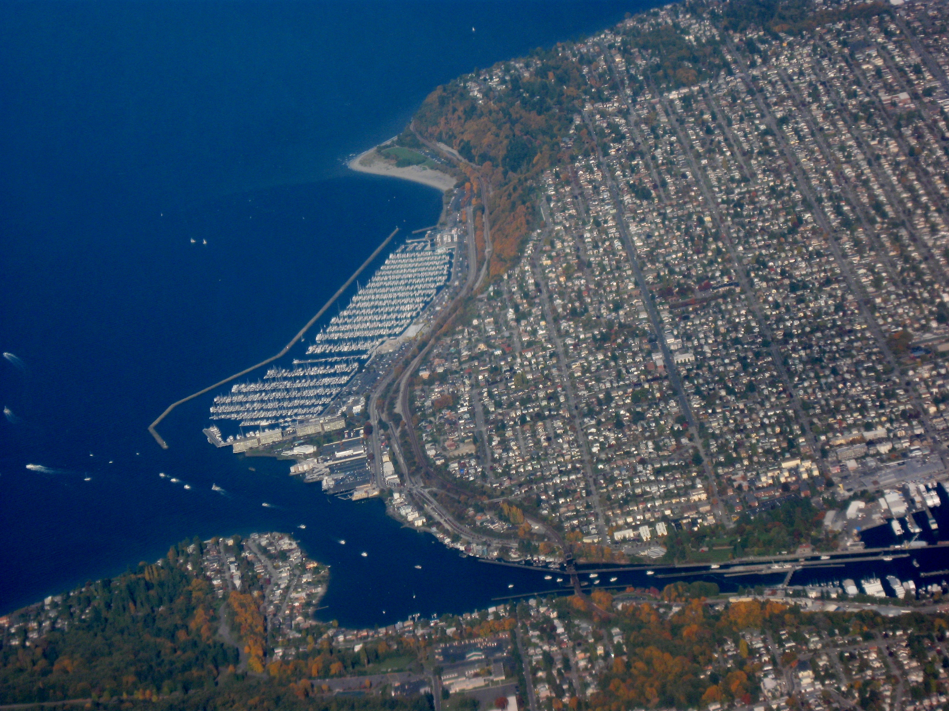
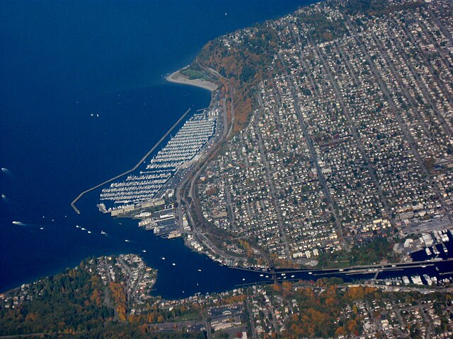
English: View of Ballard coast with various docks and marinas on Puget Sound/Shilshole Bay, facing north north west. Area near coast is Sunset Hill. The waterway at the bottom is the Lake Washington Ship Canal. On the protruding land in the top center is Golden Gardens Park. Taken by myself from a commercial airliner window. |
| Date | |
| Source | Own work |
| Author | Dcoetzee |
| Camera location | | View this and other nearby images on: OpenStreetMap |
|---|
Licensing
| I, the copyright holder of this work, release this work into the public domain. This applies worldwide. In some countries this may not be legally possible; if so: I grant anyone the right to use this work for any purpose, without any conditions, unless such conditions are required by law. |
File history
Click on a date/time to view the file as it appeared at that time.
| Date/Time | Thumbnail | Dimensions | User | Comment | |
|---|---|---|---|---|---|
| current | 03:03, 27 May 2009 | | 3,264 × 2,448 (3.49 MB) | Dcoetzee | {{Information |Description={{en|1=View of Ballard coast with various docks and marinas on Puget Sound/Shilshole Bay, facing north north west. Area near coast is Sunset Hill. The waterway at the bottom is the Lake Washington Ship Canal. On the protruding l |
File usage
The following pages on the English Wikipedia use this file (pages on other projects are not listed):
Global file usage
The following other wikis use this file:
- Usage on eo.wikipedia.org
- Usage on fr.wikipedia.org
- Usage on nl.wikipedia.org
- Usage on no.wikipedia.org
- Usage on tr.wikipedia.org
- Usage on www.wikidata.org