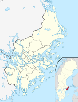
Bogesundslandet
Bogesundslandet | |
|---|---|
 | |
| Coordinates: 59°24′N 18°16′E / 59.400°N 18.267°E | |
| Country | Sweden |
| Province | Uppland |
| County | Stockholm County |
| Municipality | Vaxholm Municipality |
| Time zone | UTC+1 (CET) |
| • Summer (DST) | UTC+2 (CEST) |
Bogesundslandet is a peninsular in Vaxholm Municipality, Stockholm County, Sweden. Most of the peninsular is occupied by the Bogesundslandet nature reserve.[1][2]
The peninsular[edit]
The Bogesundslandet peninsular is largely surrounded by water, with the Kyrkfjärden in the north-west, Stora Värtan in the west, Askrikefjärden in the south and the multiple waterways and islands of Vaxholm Municipality in the east and north-east. To the north a narrow neck of land connects it to the rest of the Swedish mainland.[1][2][3]
At the south-eastern tip of the peninsular is the settlement of Karlsudd and the nearby Bogesund Castle, built by the Brahe family, who at one time owned the entire peninsular. At the western end of the peninsular, the small community and former manor of Frösvik can be found.[1][2][3]
The peninsular has a road connection to the Vaxholm urban area via the Pålsundsbron. The road from the bridge continues north across the peninsular, passing the entrances to Karlsudd and Bogesund Castle, to join county road 274 at its northern edge. Other local roads branch off to connect to other parts of the peninsular, including Frösvik.[1][4]
In the mid-1960s, Bogesundslandet was planned to be developed with housing and a motorway via Lidingö, plans that were later shelved.[citation needed]
The nature reserve[edit]
The Bogesundslandet nature reserve was formed in 2015 with the Swedish state as owner and the Swedish Property Agency as manager. The reserve covers an area of 4,341 hectares (10,730 acres), of which 2,899 hectares (7,160 acres) are land and 1,441 hectares (3,560 acres) are water. Of the land area, 2,207 hectares (5,450 acres) are productive forest land.[2][3]
References[edit]
- ^ a b c d "Interactive map - Bogesundslandet". hitta.se. Archived from the original on 13 June 2023. Retrieved 13 June 2023.
- ^ a b c d "Bogesundslandet Naturreservat" [Bogesundlandet Nature Reserve]. skyddadnatur.naturvardsverket.se (in Swedish). Swedish Environmental Protection Agency. Archived from the original on 13 June 2023. Retrieved 13 June 2023.
- ^ a b c "Bogesundslandet". Vaxholms stad. Archived from the original on 17 October 2018. Retrieved 13 June 2023.
- ^ "Vaxholms broar" [Vaxholm's bridges]. Upplevvaxholm.se (in Swedish). Archived from the original on 26 May 2023. Retrieved 26 May 2023.


