
File:LocationIndianOcean.png
Size of this preview: 800 × 405 pixels. Other resolutions: 320 × 162 pixels | 640 × 324 pixels | 1,024 × 519 pixels | 1,280 × 648 pixels | 2,760 × 1,398 pixels.
Original file (2,760 × 1,398 pixels, file size: 91 KB, MIME type: image/png)
| This is a file from the Wikimedia Commons. Information from its description page there is shown below. Commons is a freely licensed media file repository. You can help. |
Summary
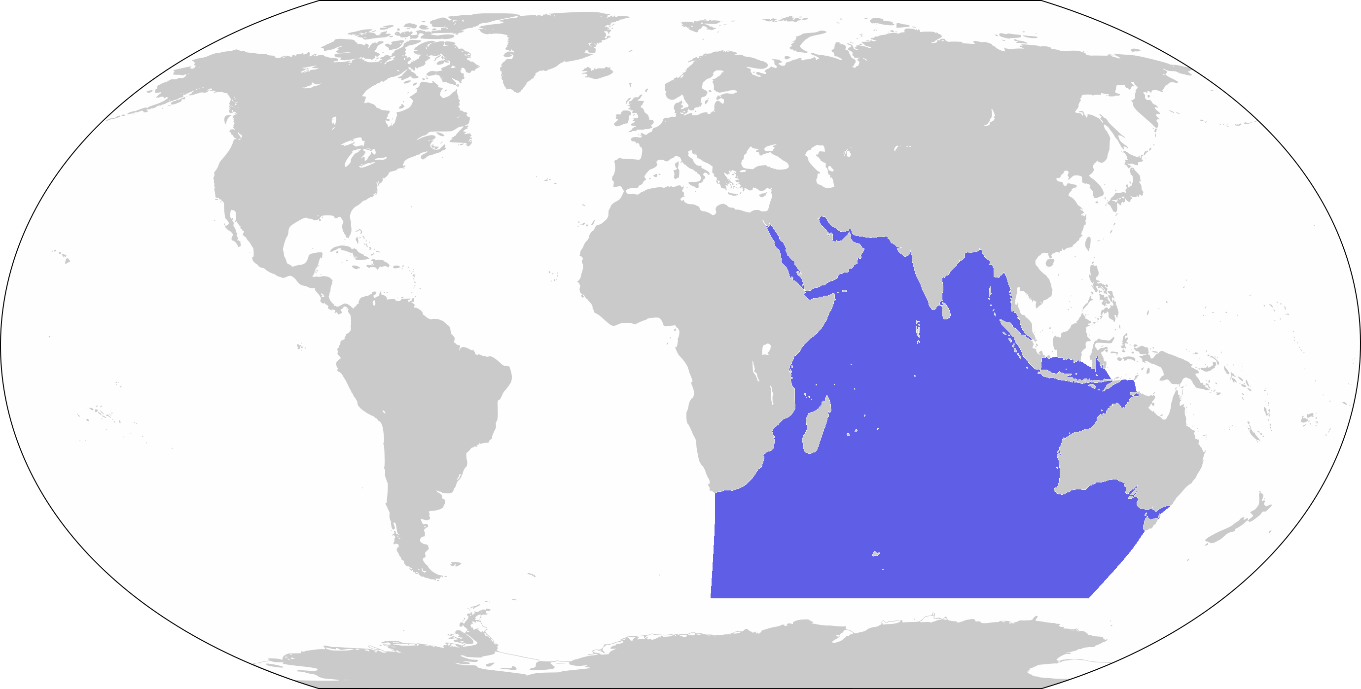
| Description | World map depicting Indian Ocean; map adapted from PDF World map at CIA World Fact Book |
| Date | |
| Source | 800px-LocationBlank.png |
| Author | user:Xfigpower |
Licensing
This image is in the public domain because it contains materials that originally came from the United States Central Intelligence Agency's World Factbook.
|
 |
File history
Click on a date/time to view the file as it appeared at that time.
| Date/Time | Thumbnail | Dimensions | User | Comment | |
|---|---|---|---|---|---|
| current | 10:39, 27 March 2019 | | 2,760 × 1,398 (91 KB) | Lasunncty | Higher resolution and more accurate boundaries |
| 13:56, 30 November 2006 |  | 800 × 407 (72 KB) | Xfigpower | {{Information |Description=World map depicting Indian Ocean; map adapted from PDF World map at CIA World Fact Book |Source=800px-LocationBlank.png |Date=2006-11-30 |Author=user:Xfigpower |Permission |
File usage
No pages on the English Wikipedia use this file (pages on other projects are not listed).
Global file usage
The following other wikis use this file:
- Usage on an.wikipedia.org
- Usage on ar.wikipedia.org
- جزر القمر
- مضيق هرمز
- الخليج العربي
- سريلانكا
- المحيط الهندي
- زلزال وتسونامي المحيط الهندي 2004
- المحيط الهادئ
- قناة السويس
- تصنيف:جزر القمر
- نياس
- المالديف
- سيشل
- مدغشقر
- موريشيوس
- بنط
- شبه الجزيرة العربية
- تصنيف:موريشيوس
- بحر العرب
- باس (مضيق)
- ميناء جبل علي
- البحر الأحمر
- برنيس
- سفاجا
- ماليه
- باب المندب
- خليج العقبة
- خليج السويس
- بوبيان
- جسر الملك فهد
- فيلكا
- اللؤلؤة قطر
- مومباسا
- مايوت
- تيران (مضيق)
- معركة ديو
- بالي
- الحلانيات (جزر)
- زلزال سومطرة 2005
- تصنيف:مدغشقر
- مقديشو
- جاوة
- بورتسودان
- حادث عبارة السلام 98
- المحيط المتجمد الشمالي
- خليج عدن
- القرن الإفريقي
- سترة (البحرين)
- سومطرة
View more global usage of this file.