
File:Iowa 1718.jpg

Size of this preview: 800 × 533 pixels. Other resolutions: 320 × 213 pixels | 640 × 426 pixels | 1,024 × 682 pixels | 1,280 × 853 pixels | 1,560 × 1,039 pixels.
Original file (1,560 × 1,039 pixels, file size: 488 KB, MIME type: image/jpeg)
| This is a file from the Wikimedia Commons. Information from its description page there is shown below. Commons is a freely licensed media file repository. You can help. |
| Description |
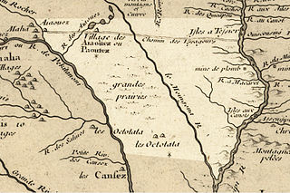
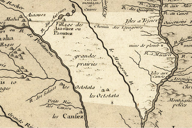
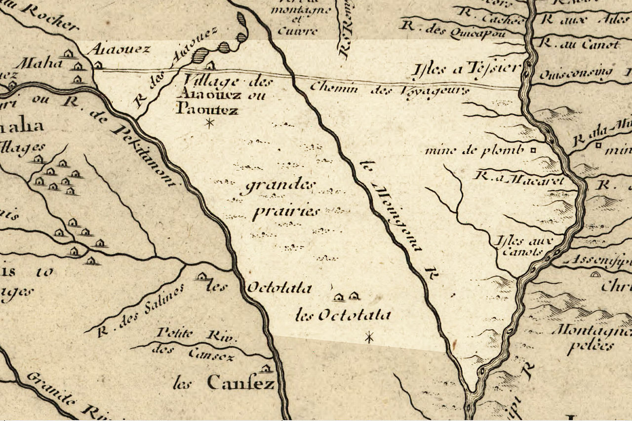
English: Iowa 1718, approximate modern state area highlighted, from Carte de la Louisiane et du cours du Mississipi by Guillaume de L'Isle. generally accepted translations: "Aiaouez"= Ioway; 'Octotata"=Otoe; "Moingona"= Des Moines River; "Macaret"= Maquoketa River; "Chemin des Voyageurs"= Main Voyageur’s Trail. "Paoutez" is probably a varaint of "Báxoje" (Ioway) which has an alternative pronounciation of [ˌpaˈxodʒɛ]. Other tribes include the "Cansez"= Kansa, and "Maha"= Omaha. |
|||||||||||||||||||||||
| Date | (mod. 2009) | |||||||||||||||||||||||
| Source | Library of Congress Public Domain Site: http://hdl.loc.gov/loc.gmd/g3700.ct000666 | |||||||||||||||||||||||
| Author |
|
|||||||||||||||||||||||
| Permission (Reusing this file) |
US Govt Public Domain, also author +100 years | |||||||||||||||||||||||

Licensing
|
This work is in the public domain in its country of origin and other countries and areas where the copyright term is the author's life plus 100 years or fewer. | |
| This file has been identified as being free of known restrictions under copyright law, including all related and neighboring rights. | |
Original upload log
The original description page was here. All following user names refer to en.wikipedia.
- 2009-02-16 20:57 Billwhittaker 1560×1039× (499934 bytes) cleaner, better res., same base map, slightly better defined Iowa.
- 2009-02-16 14:44 Billwhittaker 633×369× (145834 bytes) {{Information |Description=Iowa 1718, approximate modern state area highlighted, from ''Carte de la Louisiane et du cours du Mississipi'' by Guillaume de L'Isle. generally accepted translations: Aiaouez= Ioway; Octotata=Otoe; Moingona= Des Moines. |Sourc
File history
Click on a date/time to view the file as it appeared at that time.
| Date/Time | Thumbnail | Dimensions | User | Comment | |
|---|---|---|---|---|---|
| current | 19:35, 21 September 2009 | | 1,560 × 1,039 (488 KB) | Jeangagnon | {{Information |Description={{en|Iowa 1718, approximate modern state area highlighted, from ''Carte de la Louisiane et du cours du Mississipi'' by en:Guillaume de L'Isle. generally accepted translations: "Aiaouez"= en:Ioway; 'Octotata"=[[:en:O |
File usage
The following pages on the English Wikipedia use this file (pages on other projects are not listed):
Global file usage
The following other wikis use this file:
- Usage on ca.wikipedia.org
- Usage on es.wikipedia.org
- Usage on fr.wikipedia.org
- Usage on fr.wiktionary.org
- Usage on gu.wikipedia.org
- Usage on it.wikipedia.org
- Usage on ja.wikipedia.org
- Usage on kn.wikipedia.org
- Usage on ko.wikipedia.org
- Usage on pt.wikipedia.org
- Usage on zh.wikipedia.org