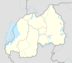
Ruhengeri
Ruhengeri
Musanze | |
|---|---|
 | |
| Coordinates: 1°30′S 29°38′E / 1.500°S 29.633°E | |
| Country | |
| Admin. Province | Northern Province |
| District | Musanze |
| Area | |
| • Muhoza sector | 8.17 sq mi (21.15 km2) |
| Elevation | 6,178 ft (1,883 m) |
| Population | |
| • Total | 135,000 |
| • Muhoza sector | 69,741 |
| • Muhoza sector density | 8,500/sq mi (3,300/km2) |
| Climate | Cfb |
Ruhengeri, also known as Musanze or Muhoza, is the third largest city in Rwanda and the capital of Musanze District in the Northern Province of Rwanda. The city has a population of 135,000 as of the 2022 census.[1]
Name[edit]
Some sources now refer to the city itself as Musanze, after the district in which it lies within.[3] This has to do with the adopted policy of renaming Rwanda cities, which was done to eliminate memories of the past and to install new administrations in the country.[citation needed]

Geography[edit]
Ruhengeri lies near the twin lakes of Lake Burera and Lake Ruhondo and is the gateway city to Volcanoes National Park and the famous mountain gorillas in the north-western part of the country.
The city's proximity to the Volcanoes National Park has made it a popular tourist destination with several restaurants and hotels mainly aimed at visitors to the national park.
Notable institutions[edit]
Ruhengeri is also home to the Institute of Applied Sciences (INES-Ruhengeri).[4] INES-Ruhengeri was established in 2003 in collaboration with the Catholic Diocese of Ruhengeri.[5]
The city is served by the Ruhengeri Airport.[6]
Notable people[edit]
- Protais Zigiranyirazo, former governor of the Ruhengeri prefecture and accused war criminal
References[edit]
- ^ a b Citypopulation.de Population of the major cities in Rwanda
- ^ Citypopulation.de Population of Muhoza sector
- ^ Briggs, Philip; Booth, Janet (2010). Rwanda. Bradt Travel Guides. p. 22. ISBN 1-84162-306-7. Retrieved 2010-06-14.
- ^ "INES-Ruhengeri". INES-Ruhengeri. Retrieved 2019-06-02.
- ^ "Educational & Research Institutions". NISR. Retrieved February 12, 2023.
- ^ "RHG - Ruhengeri [Ruhengeri Airport], 03, RW - Airport - Great Circle Mapper". www.gcmap.com. Retrieved 2018-08-21.
1°30′S 29°38′E / 1.500°S 29.633°E

