
File:Westerlichttoren.JPG
No higher resolution available.
Westerlichttoren.JPG (288 × 411 pixels, file size: 48 KB, MIME type: image/jpeg)
| This is a file from the Wikimedia Commons. Information from its description page there is shown below. Commons is a freely licensed media file repository. You can help. |
|
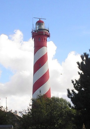
This is an image of rijksmonument number 38794 Information from structured data: |
| Description |
English: Westerlichttoren lighthouse in Haamstede, the Netherlands
Nederlands: Westerlichttoren te Haamstede
Русский: маяк Вестерлихтторен в Хамстеде (Нидерланды) |
||||||||
| Date | creation date unknown, uploaded to Dutch Wikipedia on August 12, 2006 | ||||||||
| Source | from Dutch Wikipedia | ||||||||
| Author | by Knowledge | ||||||||
| Permission (Reusing this file) |
|

| Camera location | | View this and other nearby images on: OpenStreetMap |
|---|
File history
Click on a date/time to view the file as it appeared at that time.
| Date/Time | Thumbnail | Dimensions | User | Comment | |
|---|---|---|---|---|---|
| current | 21:49, 26 September 2006 | | 288 × 411 (48 KB) | Kneiphof | {{Information| |Description = {{En|Westerlichttoren lighthouse in Haamstede, the Netherlands}} {{Nl|Westerlichttoren te Haamstede}} {{Ru|маяк Вестерлихтторен в Хамст� |
File usage
The following pages on the English Wikipedia use this file (pages on other projects are not listed):
- List of lighthouses in the Netherlands
- Westerlichttoren
- User:Abubakari Sixberth/sandbox
- User:Aeroid/List Lighthouses
- User:Danny Benjafield (WMDE)/sandbox
- User:Giovanni.pirrotta/sandbox
- User:Helmoony/sandbox
- User:Joseolgon/sandbox
- User:Magnus Manske/listeria test
- User:Salgo60/Museums/Stockholm
- User:Stevesuny/listeria-example
- User:Stinglehammer/Listeria example 1
- User:Stinglehammer/Wikidata Listeria example table
- User:Xabier Cañas/sandbox
- Template:Wikidata list/Tests/DutchLighthouses
Global file usage
The following other wikis use this file:
- Usage on ca.wikipedia.org
- Usage on da.wikipedia.org
- Usage on de.wikipedia.org
- Usage on es.wikipedia.org
- Usage on eu.wikipedia.org
- Usage on fr.wikipedia.org
- Usage on it.wikipedia.org
- Usage on nl.wikipedia.org
- Usage on no.wikipedia.org
- Usage on ru.wikipedia.org
- Usage on sr.wikipedia.org
- Usage on sv.wikipedia.org
- Usage on www.wikidata.org
- Q1138126
- Wikidata:WikiProject Lighthouses/lists/lighthouses by country/Netherlands
- User:Giaccai/interrogazioni/prima
- Wikidata:WikiProject Lighthouses/lists/lighthouses by range
- Wikidata:WikiProject Lighthouses/lists/lighthouses by number of steps
- User:Zache/listeria
- User:Higa4/sandbox/wdedit/
- Template:Wikidata list/testcases
- User talk:Akbarali
- Template:Wikidata list/sandbox
- User:Nikola Tulechki/Bulgarian Mountain Huts
- Usage on zea.wikipedia.org
- Usage on zh.wikipedia.org