
File:The Nottingham Canal - geograph.org.uk - 177080.jpg
No higher resolution available.
The_Nottingham_Canal_-_geograph.org.uk_-_177080.jpg (640 × 480 pixels, file size: 56 KB, MIME type: image/jpeg)
| This is a file from the Wikimedia Commons. Information from its description page there is shown below. Commons is a freely licensed media file repository. You can help. |
Summary
| Description |
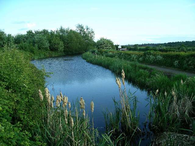
English: The Nottingham Canal. An information board near the car park at SK476433 records the following information about the canal:
The Nottingham Canal was opened in 1796 and cost £80,000. It is 14¾ miles long, running from the River Trent at Nottingham to its junction with the Erewash and Cromford Canals at Langley Mill. The Engineer was William Jessop, who was one of the greatest of the canal builders, much in demand for his skills during the last decade of the 18th century, when canal construction was at its peak.The canal was abandoned in 1937, having carried no traffic for the previous decade, but continued to receive nominal maintenance until 1971. In 1976 the Nottingham Canal Society was formed with the aim of restoring the canal for navigation between Langley Mill and Trowell. Broxtowe Borough Council originally supported this objective, but since then open cast mining has made this unrealistic, and the lengths in Council ownership are managed for nature and as a public amenity. |
| Date | |
| Source | From geograph.org.uk |
| Author | Lynne Kirton |
| Attribution (required by the license) | Lynne Kirton / The Nottingham Canal / |
| Object location | | View this and other nearby images on: OpenStreetMap |
|---|
_heading:180.00&language=en)
Licensing

|
This image was taken from the Geograph project collection. See this photograph's page on the Geograph website for the photographer's contact details. The copyright on this image is owned by Lynne Kirton and is licensed for reuse under the Creative Commons Attribution-ShareAlike 2.0 license.
|
This file is licensed under the Creative Commons Attribution-Share Alike 2.0 Generic license.
Attribution: Lynne Kirton
- You are free:
- to share – to copy, distribute and transmit the work
- to remix – to adapt the work
- Under the following conditions:
- attribution – You must give appropriate credit, provide a link to the license, and indicate if changes were made. You may do so in any reasonable manner, but not in any way that suggests the licensor endorses you or your use.
- share alike – If you remix, transform, or build upon the material, you must distribute your contributions under the same or compatible license as the original.
File history
Click on a date/time to view the file as it appeared at that time.
| Date/Time | Thumbnail | Dimensions | User | Comment | |
|---|---|---|---|---|---|
| current | 15:58, 31 January 2010 | | 640 × 480 (56 KB) | GeographBot | == {{int:filedesc}} == {{Information |description={{en|1=The Nottingham Canal. An information board near the car park at SK476433 records the following information about the canal: The Nottingham Canal was opened in 1796 and cost £80,000. It is 14¾ |
File usage
The following pages on the English Wikipedia use this file (pages on other projects are not listed):