
File:TalbotCountyMD-Hollyday.png

Size of this preview: 674 × 600 pixels. Other resolutions: 270 × 240 pixels | 539 × 480 pixels | 772 × 687 pixels.
Original file (772 × 687 pixels, file size: 1.03 MB, MIME type: image/png)
| This is a file from the Wikimedia Commons. Information from its description page there is shown below. Commons is a freely licensed media file repository. You can help. |
Summary
| Description |
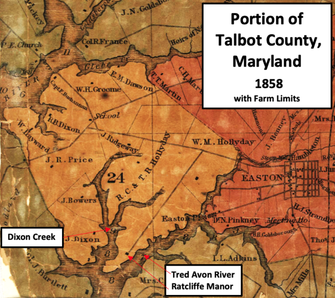
English: This is a crop of an 1858 map of Talbot County, Maryland that is divided by farm limits. It shows the land owned by the Hollyday family, including Ratcliffe Manor. |
| Date | |
| Source | This is a crop of an 1858 Talbot County Maryland map named "Map of Talbot County; with farm limits". Labels have been added by TwoScarsUp. The entire map can be find at the Library of Congress here. |
| Author | William H. Dilworth and Rae Smith |
Licensing
|
This work is in the public domain in its country of origin and other countries and areas where the copyright term is the author's life plus 70 years or fewer. This work is in the public domain in the United States because it was published (or registered with the U.S. Copyright Office) before January 1, 1929. | |
| This file has been identified as being free of known restrictions under copyright law, including all related and neighboring rights. | |
File history
Click on a date/time to view the file as it appeared at that time.
| Date/Time | Thumbnail | Dimensions | User | Comment | |
|---|---|---|---|---|---|
| current | 17:11, 23 April 2023 | | 772 × 687 (1.03 MB) | TwoScarsUp | Uploaded a work by William H. Dilworth and Rae Smith from This is a crop of an 1858 Talbot County Maryland map named "Map of Talbot County; with farm limits". Labels have been added by TwoScarsUp. The entire map can be find at the Library of Congress [https://www.loc.gov/item/2002624021/ here]. with UploadWizard |
File usage
The following pages on the English Wikipedia use this file (pages on other projects are not listed):