
File:St Anns Well- once the Nottingham Suburban Railway (geograph 3051167).jpg
Size of this preview: 798 × 599 pixels. Other resolutions: 320 × 240 pixels | 639 × 480 pixels | 1,023 × 768 pixels | 1,024 × 769 pixels.
Original file (1,024 × 769 pixels, file size: 1.2 MB, MIME type: image/jpeg)
| This is a file from the Wikimedia Commons. Information from its description page there is shown below. Commons is a freely licensed media file repository. You can help. |
.jpg)
Summary
| Description |
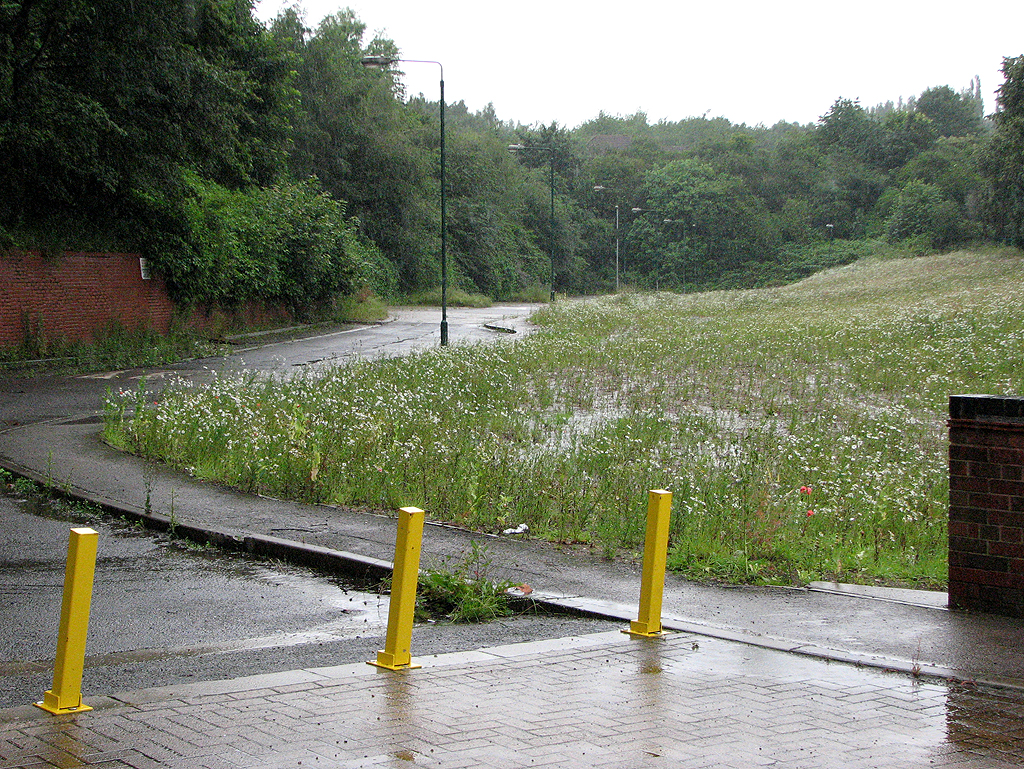
English: St Ann's Well: once the Nottingham Suburban Railway Looking towards what was from 1889-1951 the north end of St Ann's Well station and yard. Beyond the trees straight ahead the line passed under Bridge No 10 and curved gently left towards the south portal of Sherwood Tunnel, about half a mile to the north. See SK5842 : Once St Ann's Well Station Master's House for more history. |
| Date | |
| Source | From geograph.org.uk |
| Author | John Sutton |
| Permission (Reusing this file) |
Creative Commons Attribution Share-alike license 2.0 |
| Attribution (required by the license) | John Sutton / St Ann's Well: once the Nottingham Suburban Railway / |
.jpg)
| Camera location | | View this and other nearby images on: OpenStreetMap |
|---|
.jpg¶ms=052.973307_N_-001.125687_E_globe:Earth_type:camera_source:geograph-osgb36(SK58814213)_heading:337.00&language=en)
| Object location | | View this and other nearby images on: OpenStreetMap |
|---|
.jpg¶ms=052.974480_N_-001.126560_E_globe:Earth_class:object_type:object_source:geograph-osgb36(SK58754226)_heading:337.00&language=en)
Licensing

|
This image was taken from the Geograph project collection. See this photograph's page on the Geograph website for the photographer's contact details. The copyright on this image is owned by John Sutton and is licensed for reuse under the Creative Commons Attribution-ShareAlike 2.0 license.
|
This file is licensed under the Creative Commons Attribution-Share Alike 2.0 Generic license.
Attribution: John Sutton
- You are free:
- to share – to copy, distribute and transmit the work
- to remix – to adapt the work
- Under the following conditions:
- attribution – You must give appropriate credit, provide a link to the license, and indicate if changes were made. You may do so in any reasonable manner, but not in any way that suggests the licensor endorses you or your use.
- share alike – If you remix, transform, or build upon the material, you must distribute your contributions under the same or compatible license as the original.
File history
Click on a date/time to view the file as it appeared at that time.
| Date/Time | Thumbnail | Dimensions | User | Comment | |
|---|---|---|---|---|---|
| current | 21:29, 19 December 2020 | | 1,024 × 769 (1.2 MB) | Lamberhurst | Transferred from geograph.co.uk using [https://tools.wmflabs.org/geograph2commons/ geograph2commons] |
File usage
The following pages on the English Wikipedia use this file (pages on other projects are not listed):
.jpg)