
File:Sperrmauer-866.jpg
No higher resolution available.
Sperrmauer-866.jpg (500 × 371 pixels, file size: 51 KB, MIME type: image/jpeg)
| This is a file from the Wikimedia Commons. Information from its description page there is shown below. Commons is a freely licensed media file repository. You can help. |
Summary
| Description |
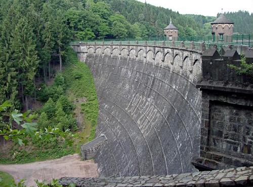
Deutsch: Sperrmauer der de:Sengbachtalsperre - Luftseite |
| Date | |
| Source | Own work |
| Author | Michael Tettinger, Solingen |
| Camera location | | View this and other nearby images on: OpenStreetMap |
|---|
Transferred from de.wikipedia to Commons by Maksim.

|
Permission is granted to copy, distribute and/or modify this document under the terms of the GNU Free Documentation License, Version 1.2 or any later version published by the Free Software Foundation; with no Invariant Sections, no Front-Cover Texts, and no Back-Cover Texts. A copy of the license is included in the section entitled GNU Free Documentation License. |
| This file is licensed under the Creative Commons Attribution-Share Alike 3.0 Unported license. | ||
| ||
| This licensing tag was added to this file as part of the GFDL licensing update. |
Original upload log
| date/time | username | edit summary |
|---|---|---|
| 16:31, 14. Apr 2004 | de:Benutzer:Tetti | |
| 13:46, 27. Feb 2004 | de:Benutzer:Tetti | (Bildbeschreibung erweitert) |
| 03:55, 27. Feb 2004 | de:Benutzer:Tetti | (Sperrmauer Sengbachtalsperre) |
File history
Click on a date/time to view the file as it appeared at that time.
| Date/Time | Thumbnail | Dimensions | User | Comment | |
|---|---|---|---|---|---|
| current | 17:09, 24 May 2016 | | 500 × 371 (51 KB) | Rrburke | Removed border by cropping 2 % horizontally and 4 % vertically using CropTool with precise mode. |
| 21:02, 21 January 2006 |  | 510 × 385 (49 KB) | Maksim | La bildo estas kopiita de wikipedia:de. La originala priskribo estas: Sperrmauer Sengbachtalsperre *Beschreibung: Sperrmauer der Sengbachtalsperre - Luftseite *Quelle: fotografiert im Mai 2003 *Fotograf: Michael Tettinger, Solingen *Andere Version |
File usage
The following pages on the English Wikipedia use this file (pages on other projects are not listed):
Global file usage
The following other wikis use this file:
- Usage on als.wikipedia.org
- Usage on arz.wikipedia.org
- Usage on cs.wikipedia.org
- Usage on cv.wikipedia.org
- Usage on da.wikipedia.org
- Usage on de.wikipedia.org
- Usage on eo.wikipedia.org
- Usage on fr.wikipedia.org
- Usage on pl.wikipedia.org
- Usage on qu.wikipedia.org
- Usage on vi.wikipedia.org
- Usage on www.wikidata.org
- Usage on zh.wikipedia.org