
File:Seismicity of Eastern margin of the Japan Sea 2.jpg
Size of this preview: 435 × 599 pixels. Other resolutions: 174 × 240 pixels | 349 × 480 pixels | 799 × 1,100 pixels.
Original file (799 × 1,100 pixels, file size: 98 KB, MIME type: image/jpeg)
| This is a file from the Wikimedia Commons. Information from its description page there is shown below. Commons is a freely licensed media file repository. You can help. |
Summary
| Description |
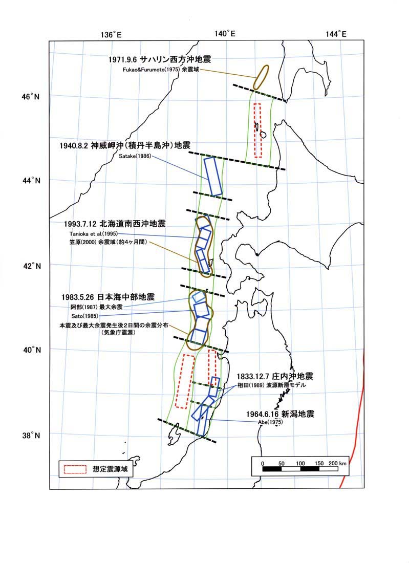
한국어: 동해 동연 변동대의 각 구분대와 관련 주요 지진을 그린 지도. |
| Date | |
| Source | https://www.jishin.go.jp/main/chousa/03jun_nihonkai/index.html |
| Author | 地震調査研究推進本部事務局 |
Licensing

|
This work is licensed under the Government of Japan Standard Terms of Use (Ver.2.0). The Terms of Use are compatible with the Creative Commons Attribution License 4.0 International. For the terms of use of this work, see this license page.
|
This file is licensed under the Creative Commons Attribution 4.0 International license.
Attribution: 地震調査研究推進本部事務局
- You are free:
- to share – to copy, distribute and transmit the work
- to remix – to adapt the work
- Under the following conditions:
- attribution – You must give appropriate credit, provide a link to the license, and indicate if changes were made. You may do so in any reasonable manner, but not in any way that suggests the licensor endorses you or your use.
File history
Click on a date/time to view the file as it appeared at that time.
| Date/Time | Thumbnail | Dimensions | User | Comment | |
|---|---|---|---|---|---|
| current | 05:50, 19 May 2021 | | 799 × 1,100 (98 KB) | Twotwo2019 | Uploaded a work by 地震調査研究推進本部事務局 from https://www.jishin.go.jp/main/chousa/03jun_nihonkai/index.html with UploadWizard |
File usage
The following pages on the English Wikipedia use this file (pages on other projects are not listed):
Global file usage
The following other wikis use this file: