
File:Rankine generating station National Map NAIP.png
No higher resolution available.
Rankine_generating_station_National_Map_NAIP.png (670 × 410 pixels, file size: 221 KB, MIME type: image/png)
| This is a file from the Wikimedia Commons. Information from its description page there is shown below. Commons is a freely licensed media file repository. You can help. |
Summary
| Description |
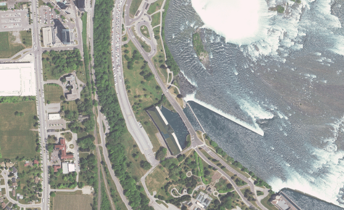
English: US National Map showing the Rankine Generating Station in Ontario. Cropped to remove wording along the bottom of the image. |
| Date | Unknown date |
| Source | US National Map, using NAIP overlay.https://viewer.nationalmap.gov/advanced-viewer/viewer/index.html?marker=-79.0787%2C43.0745%2C4326%2Cfrom%20Rankine_Generating_Station%2C%2CRankine%20Generating%20Station&scale=300000&extent=-8805778.6248%2C5322415.4778%2C-8800557.0203%2C5324431.5044%2C102100 |
| Author | USGS |
Licensing
This image is in the public domain in the United States because it only contains materials that originally came from the United States Geological Survey, an agency of the United States Department of the Interior. For more information, see the official USGS copyright policy.
|
| Annotations | This image is annotated: View the annotations at Commons |
File history
Click on a date/time to view the file as it appeared at that time.
| Date/Time | Thumbnail | Dimensions | User | Comment | |
|---|---|---|---|---|---|
| current | 01:41, 22 December 2018 | | 670 × 410 (221 KB) | Oaktree b | User created page with UploadWizard |
File usage
The following pages on the English Wikipedia use this file (pages on other projects are not listed):