
File:Payer map Franz Josef Land 1874.jpg
Size of this preview: 454 × 599 pixels. Other resolutions: 182 × 240 pixels | 364 × 480 pixels | 582 × 768 pixels | 776 × 1,024 pixels | 1,397 × 1,844 pixels.
Original file (1,397 × 1,844 pixels, file size: 413 KB, MIME type: image/jpeg)
| This is a file from the Wikimedia Commons. Information from its description page there is shown below. Commons is a freely licensed media file repository. You can help. |
Summary
| Description |
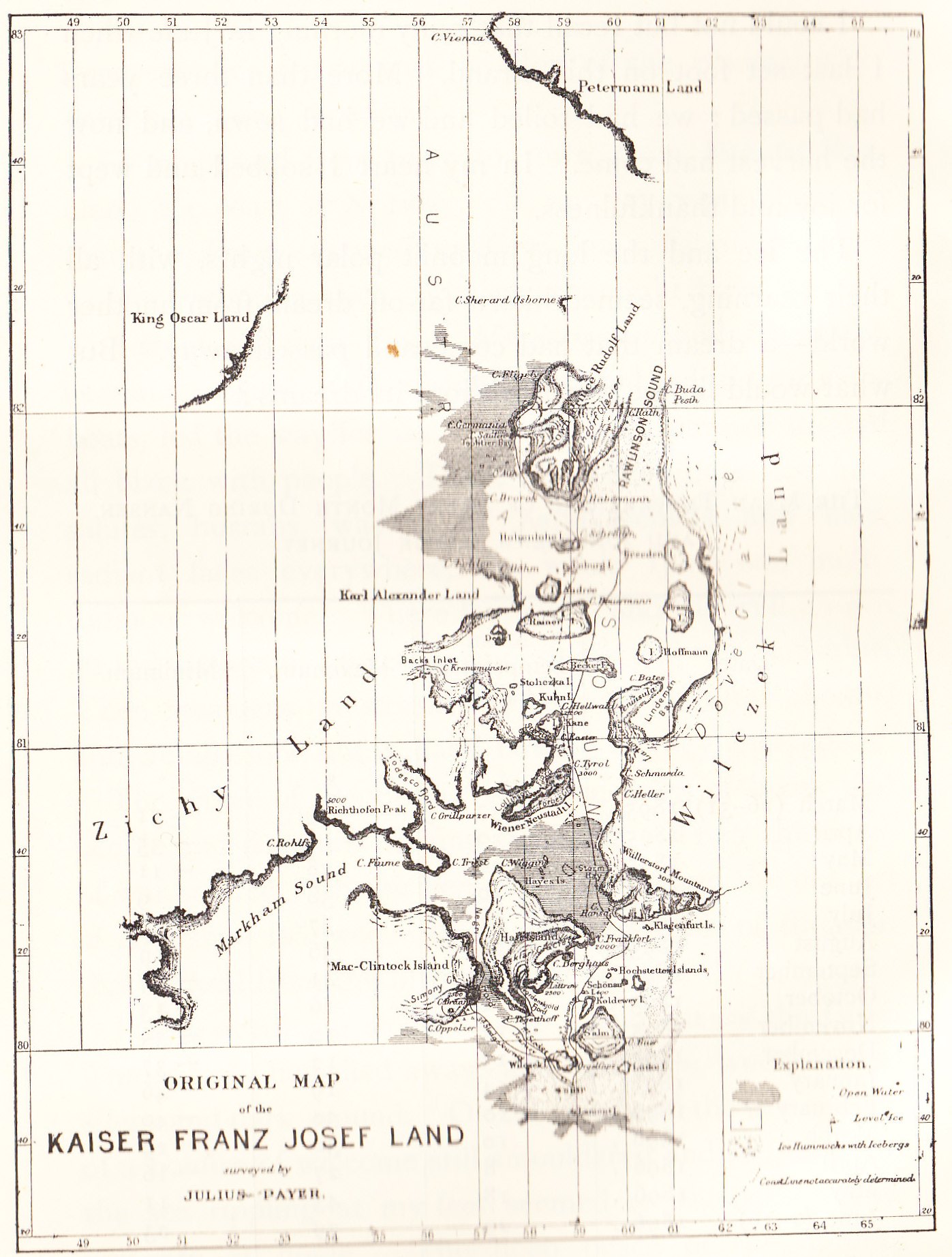
English: Old map of the Franz Josef Land archipelago drawn by the land's discoverer, Julius Payer |
| Date | circa 1874 |
| Source |
English: Nansen, Fridtjof: Farthest North, Vol II, Constable & Co, London 1897 |
| Author | Julius Payer 1841-1914 |
Licensing
This media file is in the public domain in the United States. This applies to U.S. works where the copyright has expired, often because its first publication occurred prior to January 1, 1929, and if not then due to lack of notice or renewal. See this page for further explanation.
|
 | |
 |
This image might not be in the public domain outside of the United States; this especially applies in the countries and areas that do not apply the rule of the shorter term for US works, such as Canada, Mainland China (not Hong Kong or Macao), Germany, Mexico, and Switzerland. The creator and year of publication are essential information and must be provided. See Wikipedia:Public domain and Wikipedia:Copyrights for more details.
|
Original upload log
The original description page was here. All following user names refer to en.wikipedia.
| Upload date | User | Bytes | Dimensions | Comment |
|---|---|---|---|---|
| 2009-10-07 11:26:12 | Brianboulton | 423346 | 1397×1844 | {{Information |Description = Old map of the Franz Josef Land archipelago drawn by the land's discoverer, Julius Payer |Source = Nansen, Fridtjof: ''Farthest North, Vol II'', Constable & Co, London 1897 |Date = 1874 approx |Author |
File history
Click on a date/time to view the file as it appeared at that time.
| Date/Time | Thumbnail | Dimensions | User | Comment | |
|---|---|---|---|---|---|
| current | 16:05, 15 October 2009 | | 1,397 × 1,844 (413 KB) | CommonsHelper2 Bot | {{BotMoveToCommons|en.wikipedia|year={{subst:CURRENTYEAR}}|month={{subst:CURRENTMONTHNAME}}|day={{subst:CURRENTDAY}}}} {{Information |Description = {{en |Old map of the Franz Josef Land archipelago drawn by the land's discoverer, Julius Payer }} |Sour |
File usage
The following pages on the English Wikipedia use this file (pages on other projects are not listed):
Global file usage
The following other wikis use this file:
- Usage on ast.wikipedia.org
- Usage on da.wikipedia.org
- Usage on es.wikipedia.org
- Usage on fr.wikipedia.org
- Usage on hu.wikipedia.org
- Usage on it.wikipedia.org
- Usage on ja.wikipedia.org
- Usage on no.wikipedia.org
- Usage on ru.wikipedia.org