
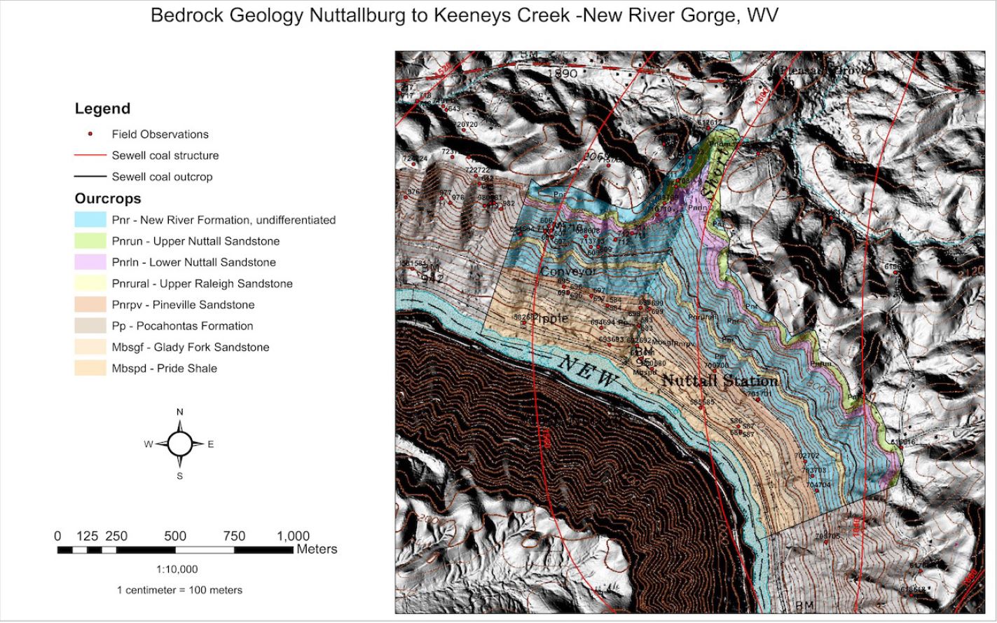
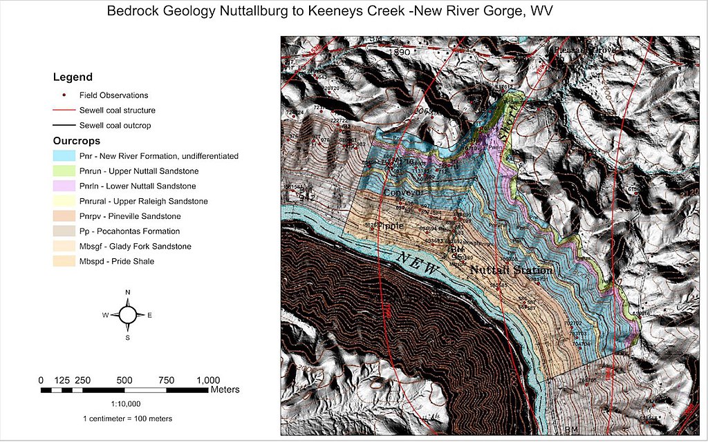
File:Nuttall geologic map.jpg
Size of this preview: 800 × 500 pixels. Other resolutions: 320 × 200 pixels | 640 × 400 pixels | 1,024 × 640 pixels | 1,423 × 889 pixels.
Original file (1,423 × 889 pixels, file size: 304 KB, MIME type: image/jpeg)
| This is a file from the Wikimedia Commons. Information from its description page there is shown below. Commons is a freely licensed media file repository. You can help. |
Summary
| Description |
English: Nuttall geologic map |
| Date | |
| Source |
Geology and History of a 19th and Early 20th Century Industrial Complex: The Nuttall Mine and Nuttallburg, West Virginia, U.S. Geological Survey Open-File Report 2014–1167 https://pubs.usgs.gov/of/2014/1167/pdf/ofr2014-1167_mccolloch-geology-and-history.pdf |
| Author | Gayle H. McColloch, Jr., and Jane S. McColloch |
Licensing
This image is in the public domain in the United States because it only contains materials that originally came from the United States Geological Survey, an agency of the United States Department of the Interior. For more information, see the official USGS copyright policy.
|
File history
Click on a date/time to view the file as it appeared at that time.
| Date/Time | Thumbnail | Dimensions | User | Comment | |
|---|---|---|---|---|---|
| current | 01:02, 27 October 2021 | | 1,423 × 889 (304 KB) | Pi3.124 | Uploaded a work by Gayle H. McColloch, Jr., and Jane S. McColloch from Geology and History of a 19th and Early 20th Century Industrial Complex: The Nuttall Mine and Nuttallburg, West Virginia, U.S. Geological Survey Open-File Report 2014–1167 https://pubs.usgs.gov/of/2014/1167/pdf/ofr2014-1167_mccolloch-geology-and-history.pdf with UploadWizard |
File usage
The following pages on the English Wikipedia use this file (pages on other projects are not listed):