
File:Norway location map.svg

Size of this PNG preview of this SVG file: 564 × 599 pixels. Other resolutions: 226 × 240 pixels | 452 × 480 pixels | 723 × 768 pixels | 964 × 1,024 pixels | 1,928 × 2,048 pixels | 2,215 × 2,353 pixels.
Original file (SVG file, nominally 2,215 × 2,353 pixels, file size: 1.32 MB)
| This is a file from the Wikimedia Commons. Information from its description page there is shown below. Commons is a freely licensed media file repository. You can help. |
Summary
| Description |
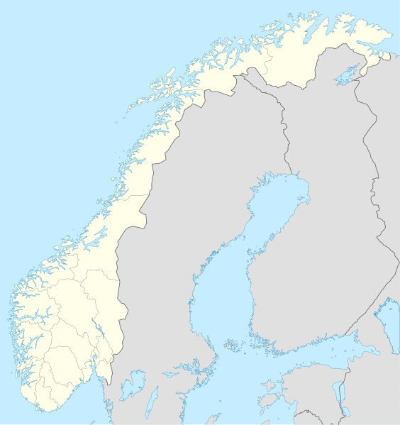
Deutsch: Positionskarte von Norwegen
Quadratische Plattkarte, N-S-Streckung 210 %. Geographische Begrenzung der Karte:
English: Location map of Norway
Equirectangular projection, N/S stretching 210 %. Geographic limits of the map:
|
| Date | |
| Source |
own work, using
|
| Author | NordNordWest |
| Other versions | Derivative works of this file: Regenbogen location map.svg |

|
This map has been made or improved in the German Kartenwerkstatt (Map Lab). You can propose maps to improve as well.
|
Licensing
I, the copyright holder of this work, hereby publish it under the following licenses:

|
Permission is granted to copy, distribute and/or modify this document under the terms of the GNU Free Documentation License, Version 1.2 or any later version published by the Free Software Foundation; with no Invariant Sections, no Front-Cover Texts, and no Back-Cover Texts. A copy of the license is included in the section entitled GNU Free Documentation License. |
This file is licensed under the Creative Commons Attribution-Share Alike 3.0 Unported license.
- You are free:
- to share – to copy, distribute and transmit the work
- to remix – to adapt the work
- Under the following conditions:
- attribution – You must give appropriate credit, provide a link to the license, and indicate if changes were made. You may do so in any reasonable manner, but not in any way that suggests the licensor endorses you or your use.
- share alike – If you remix, transform, or build upon the material, you must distribute your contributions under the same or compatible license as the original.
You may select the license of your choice.
File history
Click on a date/time to view the file as it appeared at that time.
| Date/Time | Thumbnail | Dimensions | User | Comment | |
|---|---|---|---|---|---|
| current | 20:59, 30 December 2017 | | 2,215 × 2,353 (1.32 MB) | NordNordWest | upd |
| 20:26, 25 October 2008 |  | 2,215 × 2,353 (2.12 MB) | NordNordWest | corrected | |
| 07:56, 29 August 2008 |  | 2,215 × 2,351 (2.12 MB) | NordNordWest | ||
| 20:12, 28 July 2008 |  | 2,214 × 2,351 (1.81 MB) | NordNordWest | some corrections | |
| 19:47, 28 July 2008 |  | 2,214 × 2,351 (1.81 MB) | NordNordWest | {{Information |Description= {{de|Positionskarte der Norwegen}} Quadratische Plattkarte, N-S-Streckung 210 %. Geographische Begrenzung der Karte: * N: 71.5° N * S: 57.6° N * W: 4.1° O * O: 31.6° O {{en|Location map of [[:en:Norway|Norw |
File usage
More than 100 pages use this file. The following list shows the first 100 pages that use this file only. A full list is available.
- 1952 Winter Olympics
- 1994 Winter Olympics
- 2003 Tippeligaen
- 2004 Tippeligaen
- Alsta
- Alversund
- Angvik
- Arøya
- Aust-Agder
- Bakka, Aurland
- Bardufoss
- Bruland
- Brumunddal
- Bryne
- Brønnøysund
- Bud, Norway
- Burfjord
- Byåsen
- Båsmoen
- Degnepoll
- Drøbak
- Egersund
- Eik, Rogaland
- Eliteserien
- Elnesvågen
- Engøy
- Eurovision Song Contest 1986
- Extreme points of Norway
- Fauskevåg
- Flesland
- Florø
- Follebu
- Gardnos crater
- Geiranger
- Gossa (island)
- Grip, Norway
- Haltdalen
- Hamar
- Hell, Norway
- Herdla (island)
- Hinnøya
- Hof, Vestfold
- Holmefjord
- Holmestrand
- Holta
- Hordaland
- Husa
- Husavik, Norway
- Hønefoss
- Kirkenes
- Klepp stasjon
- Kleppe
- Kleppestø
- Kristiansand
- Kyrksæterøra
- Leirvik
- Lofoten
- Lokøy
- Magerøya
- Masi, Norway
- Melbu
- Mo i Rana
- Moelv
- Moi, Norway
- Morgedal
- Mosjøen
- Mågerø
- Nesøya, Akershus
- Numedal
- Nystad, Nordland
- Operation Archery
- Operation Freshman
- Oppland
- Raufoss
- Rjukan
- Romerike
- Royal Norwegian Air Force
- Rørvik
- Sagesund
- Sande, Vestfold
- Sandland
- Sandnes
- Sandnessjøen
- Sandvika
- Senja
- Skjerstad
- Sogn og Fjordane
- Spjelkavik
- Sundal
- Sundøy
- Svelvik
- Tautra
- Tomrefjord
- Trondheim
- Tønsberg
- Verdens Ende
- Vest-Agder
- Vingnes
- Årdalstangen
- Åse, Nordland
View more links to this file.
Global file usage
The following other wikis use this file:
- Usage on af.wikipedia.org
- Usage on als.wikipedia.org
- Usage on an.wikipedia.org
- Usage on ar.wikipedia.org
- Usage on ast.wikipedia.org
- Estrechu de Skagerrak
- Mar del Norte
- Oslu
- Kinnarodden
- Cabu Norte
- Fiordu de Trondheim
- Fiordu de Bøk
- Fiordu de Geiranger
- Fiordu de Nærøy
- Ríu Tana
- Península Escandinava
- Bergen
- Trondheim
- Ópera d'Oslu
- Fiordu d'Oslu
- Edificiu del Storting
- Ramnefjellsfossen
- Mongefossen
- Kjelfossen
- Knivskjelodden
- Magerøyá
- Palaciu Real d'Oslu
- Catedral de Nidaros
- Bolsa d'Oslu
- Módulu:Mapa de llocalización/datos/Noruega
- Módulu:Mapa de llocalización/datos/Noruega/usu
- Haraldshaugen
- Sverd i fjell
- Aeropuertu d'Alta
- Aeropuertu d'Andøyá-Andenes
- Aeropuertu de Bardufoss
View more global usage of this file.