
File:National Weather Service Rainfall map for July 2023 Kentucky floods.png

Size of this preview: 800 × 528 pixels. Other resolutions: 320 × 211 pixels | 640 × 422 pixels | 1,024 × 676 pixels | 1,280 × 845 pixels | 1,556 × 1,027 pixels.
Original file (1,556 × 1,027 pixels, file size: 504 KB, MIME type: image/png)
| This is a file from the Wikimedia Commons. Information from its description page there is shown below. Commons is a freely licensed media file repository. You can help. |
Summary
| Description |
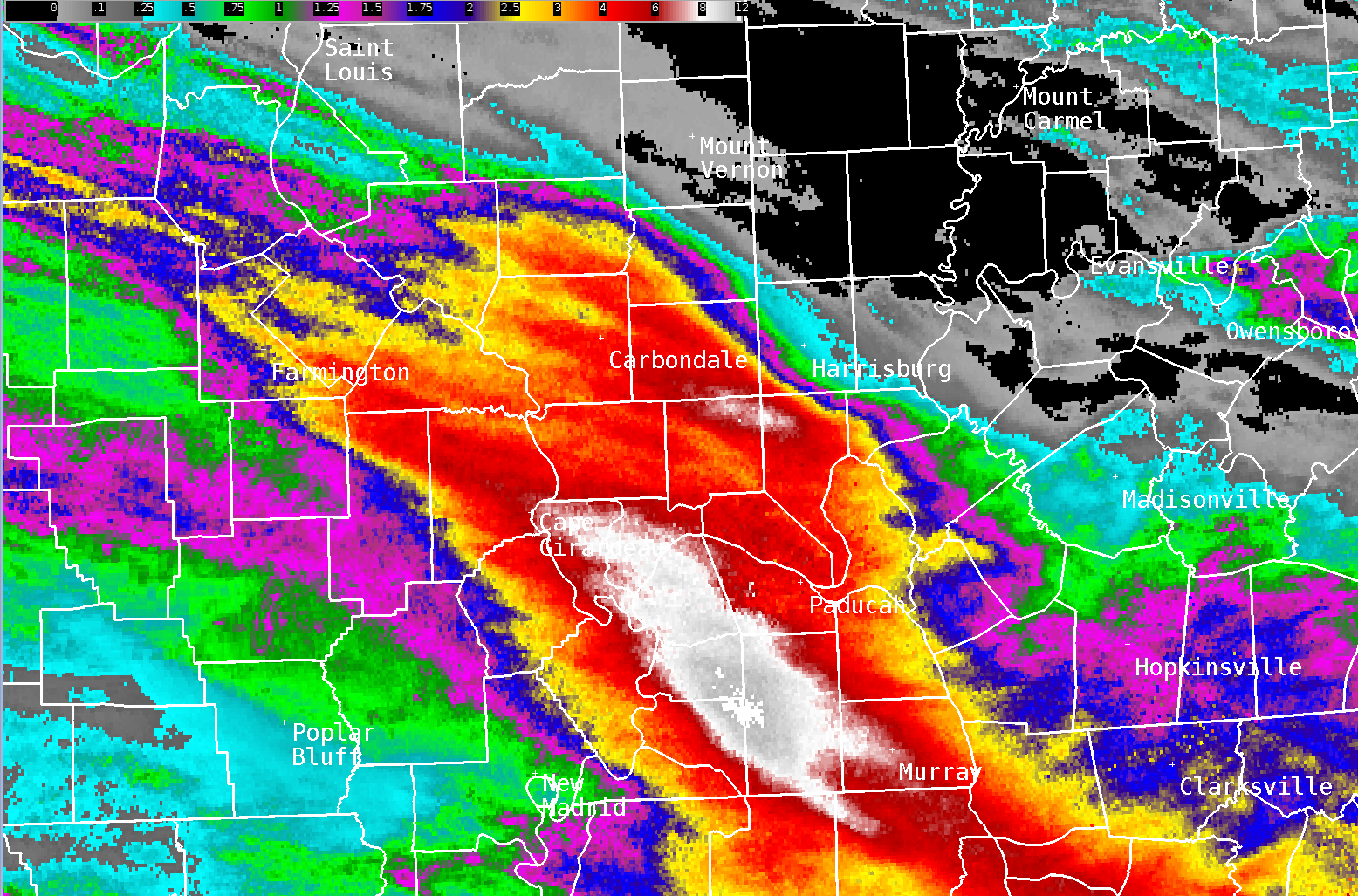
English: A total rainfall map from the National Weather Service for the historic July 2023 Western Kentucky floods. |
| Date | |
| Source | https://www.weather.gov/pah/FloodingJuly19_2023 (Exact URL) |
| Author | National Weather Service in Paducah, Kentucky |
Licensing
This image is in the public domain because it contains materials that originally came from the U.S. National Oceanic and Atmospheric Administration, taken or made as part of an employee's official duties.
|
File history
Click on a date/time to view the file as it appeared at that time.
| Date/Time | Thumbnail | Dimensions | User | Comment | |
|---|---|---|---|---|---|
| current | 18:01, 23 July 2023 | | 1,556 × 1,027 (504 KB) | WeatherWriter | Uploaded a work by National Weather Service in Paducah, Kentucky from https://www.weather.gov/pah/FloodingJuly19_2023 ([https://www.weather.gov/images/pah/StormEvents/2023/July%2019%20Flooding/MRMS%20Radar%20Estimates.png Exact URL]) with UploadWizard |
File usage
The following pages on the English Wikipedia use this file (pages on other projects are not listed):