
File:National Lacrosse League team locations.svg

Size of this PNG preview of this SVG file: 800 × 562 pixels. Other resolutions: 320 × 225 pixels | 640 × 450 pixels | 1,024 × 720 pixels | 1,280 × 900 pixels | 2,560 × 1,800 pixels | 926 × 651 pixels.
Original file (SVG file, nominally 926 × 651 pixels, file size: 575 KB)
| This is a file from the Wikimedia Commons. Information from its description page there is shown below. Commons is a freely licensed media file repository. You can help. |
Summary
| Description |
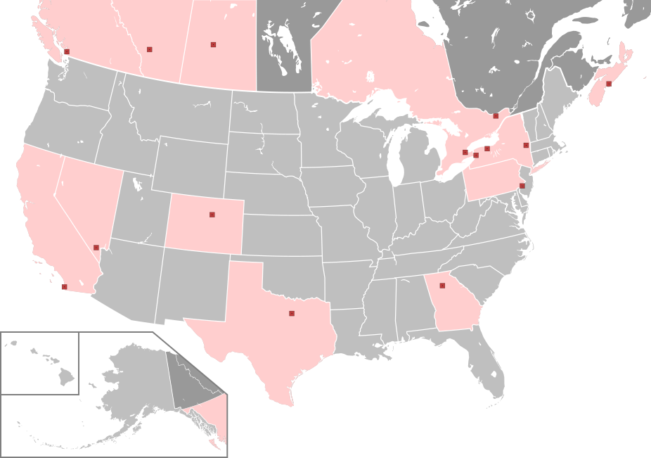
English: National Lacrosse League (NLL) Divisions. The locations of all teams are marked with squares. Inside each are a small black square indicating the exact location of each team's stadium. States and provinces that host a team are highlighted.
National Lacrosse League team |
| Date | |
| Source | Derived from File:North America map with states and provinces.svg by Kaldari and Halava |
| Author | Spesh531 |
Licensing
This file is licensed under the Creative Commons Attribution-Share Alike 4.0 International license.
- You are free:
- to share – to copy, distribute and transmit the work
- to remix – to adapt the work
- Under the following conditions:
- attribution – You must give appropriate credit, provide a link to the license, and indicate if changes were made. You may do so in any reasonable manner, but not in any way that suggests the licensor endorses you or your use.
- share alike – If you remix, transform, or build upon the material, you must distribute your contributions under the same or compatible license as the original.
File history
Click on a date/time to view the file as it appeared at that time.
| Date/Time | Thumbnail | Dimensions | User | Comment | |
|---|---|---|---|---|---|
| current | 02:55, 7 May 2024 | | 926 × 651 (575 KB) | Spesh531 | No conferences |
| 02:54, 7 May 2024 |  | 926 × 651 (575 KB) | Spesh531 | Revert to this for the 2025 season | |
| 23:27, 5 July 2023 |  | 926 × 651 (575 KB) | Spesh531 | Adding British Columbia highlight in the bottom left box | |
| 03:32, 4 July 2023 |  | 926 × 651 (567 KB) | Spesh531 | Uploaded a work by Spesh531 from Derived from File:North America map with states and provinces.svg by Kaldari and Halava with UploadWizard |
File usage
The following pages on the English Wikipedia use this file (pages on other projects are not listed):