
File:MSTL Map.png
Size of this preview: 667 × 600 pixels. Other resolutions: 267 × 240 pixels | 534 × 480 pixels | 854 × 768 pixels | 1,038 × 933 pixels.
Original file (1,038 × 933 pixels, file size: 275 KB, MIME type: image/png)
| This is a file from the Wikimedia Commons. Information from its description page there is shown below. Commons is a freely licensed media file repository. You can help. |
Summary
| Description |
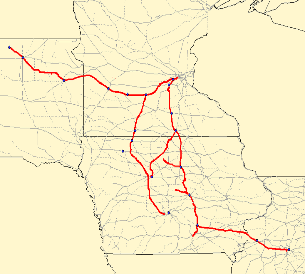
Map of the . Red lines are the MSTL route; gray lines are other railroads. Created using Quantum GIS using data from the Bureau of Transportation Statistics under "Railway Network (1:100,000 base scale)" and queried against the previous railroad of "MSTL". Rechecked against Cash Groth's site and missing/dirty data filled in. |
| Date | 2 September 2006 (original upload date) |
| Source |
Transferred from en.wikipedia to Commons. |
| Author | Elkman at English Wikipedia |
Licensing
This file is licensed under the Creative Commons Attribution-Share Alike 2.5 Generic, 2.0 Generic and 1.0 Generic license.
- You are free:
- to share – to copy, distribute and transmit the work
- to remix – to adapt the work
- Under the following conditions:
- attribution – You must give appropriate credit, provide a link to the license, and indicate if changes were made. You may do so in any reasonable manner, but not in any way that suggests the licensor endorses you or your use.
- share alike – If you remix, transform, or build upon the material, you must distribute your contributions under the same or compatible license as the original.
| This file is licensed under the Creative Commons Attribution-Share Alike 3.0 Unported license. Subject to disclaimers. | ||
| ||
| This licensing tag was added to this file as part of the GFDL licensing update. |

|
Permission is granted to copy, distribute and/or modify this document under the terms of the GNU Free Documentation License, Version 1.2 or any later version published by the Free Software Foundation; with no Invariant Sections, no Front-Cover Texts, and no Back-Cover Texts. A copy of the license is included in the section entitled GNU Free Documentation License. Subject to disclaimers. |
I, the copyright holder of this work, hereby publish it under the following license:
I, the copyright holder of this work, hereby publish it under the following license:
Original upload log
The original description page was here. All following user names refer to en.wikipedia.
- 2006-09-02 04:35 Elkman 1038×933×8 (281134 bytes) Map of the [[Minneapolis and St. Louis Railway]]. Red lines are the MSTL route; gray lines are other railroads. Created using Quantum GIS using data from [http://www.bts.gov/publications/national_transportation_atlas_database/2006/ the Bureau of Transpo
File history
Click on a date/time to view the file as it appeared at that time.
| Date/Time | Thumbnail | Dimensions | User | Comment | |
|---|---|---|---|---|---|
| current | 16:25, 24 June 2007 | | 1,038 × 933 (275 KB) | SieBot | {{Information |Description=Map of the en:Minneapolis and St. Louis Railway. Red lines are the MSTL route; gray lines are other railroads. Created using Quantum GIS using data from [http://www.bts.gov/publications/national_transportation_atlas_data |
File usage
The following pages on the English Wikipedia use this file (pages on other projects are not listed):
Global file usage
The following other wikis use this file:
- Usage on fr.wikipedia.org
- Usage on it.wikipedia.org
- Usage on ro.wikipedia.org
- Berwick, Iowa
- Des Moines, Iowa
- Categorie:Statul Iowa, SUA
- Iowa
- Iowa (dezambiguizare)
- Format:Iowa stat SUA
- Categorie:Formate Iowa
- Categorie:Liste Iowa
- Categorie:Comitate din statul Iowa, SUA
- Buffalo, Iowa
- Listă de oameni din statul Iowa
- Categorie:Guvernul statului Iowa
- Listă de comitate din statul Iowa
- Categorie:Sedii de comitate din Iowa
- Categorie:Comitatul Washington, Iowa
- Listă de orașe din statul Iowa
- Categorie:Comitatul Adams, Iowa
- Comitatul Adams, Iowa
- Categorie:Comitatul Adair, Iowa
- Categorie:Comitatul Allamakee, Iowa
- Categorie:Comitatul Appanoose, Iowa
- Categorie:Comitatul Audubon, Iowa
- Categorie:Comitatul Benton, Iowa
- Categorie:Comitatul Black Hawk, Iowa
- Categorie:Comitatul Boone, Iowa
- Categorie:Comitatul Bremer, Iowa
- Categorie:Comitatul Buchanan, Iowa
- Categorie:Comitatul Buena Vista, Iowa
- Categorie:Comitatul Cedar, Iowa
- Categorie:Comitatul Cerro Gordo, Iowa
- Categorie:Comitatul Cherokee, Iowa
- Categorie:Comitatul Chickasaw, Iowa
- Categorie:Comitatul Clarke, Iowa
- Categorie:Comitatul Clay, Iowa
- Categorie:Comitatul Clinton, Iowa
- Categorie:Comitatul Crawford, Iowa
- Categorie:Comitatul Davis, Iowa
- Categorie:Comitatul Decatur, Iowa
- Categorie:Comitatul Delaware, Iowa
- Categorie:Comitatul Des Moines, Iowa
- Categorie:Comitatul Polk, Iowa
- Categorie:Comitatul Dickinson, Iowa
- Manchester, Iowa
- Categorie:Comitatul Dubuque, Iowa
- Categorie:Comitatul Emmet, Iowa
- Categorie:Comitatul Fayette, Iowa
- Categorie:Comitatul Floyd, Iowa
- Categorie:Comitatul Franklin, Iowa
View more global usage of this file.