
File:Katros upė ties Pogarenda.JPG

Size of this preview: 397 × 599 pixels. Other resolutions: 159 × 240 pixels | 318 × 480 pixels | 509 × 768 pixels | 678 × 1,024 pixels | 1,356 × 2,048 pixels | 3,264 × 4,928 pixels.
Original file (3,264 × 4,928 pixels, file size: 7.67 MB, MIME type: image/jpeg)
| This is a file from the Wikimedia Commons. Information from its description page there is shown below. Commons is a freely licensed media file repository. You can help. |
Summary
| Description |
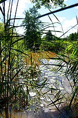
Lietuvių: Katros upė nuo Pogarendos pusės, Varėnos raj. |
||
| Date | |||
| Source | Own work | ||
| Author | Hugo.arg | ||
| Permission (Reusing this file) |
|
| Camera location | | View this and other nearby images on: OpenStreetMap |
|---|
File history
Click on a date/time to view the file as it appeared at that time.
| Date/Time | Thumbnail | Dimensions | User | Comment | |
|---|---|---|---|---|---|
| current | 17:35, 13 August 2020 | | 3,264 × 4,928 (7.67 MB) | Hugo.arg | {{Information |Description={{lt|Katros upė nuo Pogarendos pusės, Varėnos raj.}} |Source={{own}} |Date=2020-08-13 |Author=Hugo.arg |Permission={{PD-self}} |other_versions= }} Category:Pogarenda Category:Katra |
File usage
The following pages on the English Wikipedia use this file (pages on other projects are not listed):
Global file usage
The following other wikis use this file:
- Usage on arz.wikipedia.org
- Usage on avk.wikipedia.org
- Usage on be-tarask.wikipedia.org
- Usage on be.wikipedia.org
- Usage on ceb.wikipedia.org
- Usage on cs.wikipedia.org
- Usage on da.wikipedia.org
- Usage on fa.wikipedia.org
- Usage on lt.wikipedia.org
- Usage on nn.wikipedia.org
- Usage on pl.wikipedia.org
- Usage on ru.wikipedia.org
- Usage on sr.wikipedia.org
- Usage on uk.wikipedia.org
- Usage on www.wikidata.org