
File:John Speed's map of Landaffe (cropped).png
No higher resolution available.
John_Speed's_map_of_Landaffe_(cropped).png (214 × 155 pixels, file size: 77 KB, MIME type: image/png)
| This is a file from the Wikimedia Commons. Information from its description page there is shown below. Commons is a freely licensed media file repository. You can help. |
Summary
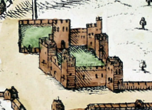
| Description | Llandaff, Wales, 1610 | ||||
| Date | |||||
| Source | cardiffparks.org.uk/ | ||||
| Author | John Spped | ||||
| Permission (Reusing this file) |
|
||||
| Other versions | |||||


.png)
File history
Click on a date/time to view the file as it appeared at that time.
| Date/Time | Thumbnail | Dimensions | User | Comment | |
|---|---|---|---|---|---|
| current | 21:24, 7 June 2022 | | 214 × 155 (77 KB) | Seth Whales | File:John Speed's map of Landaffe.png cropped 80 % horizontally, 81 % vertically using CropTool with precise mode. |
File usage
The following pages on the English Wikipedia use this file (pages on other projects are not listed):
.png)