
File:Hurricane Jova Oct 10 2011 1740Z.jpg

Size of this preview: 600 × 600 pixels. Other resolutions: 240 × 240 pixels | 480 × 480 pixels | 768 × 768 pixels | 1,024 × 1,024 pixels | 2,048 × 2,048 pixels | 5,760 × 5,760 pixels.
Original file (5,760 × 5,760 pixels, file size: 4.18 MB, MIME type: image/jpeg)
| This is a file from the Wikimedia Commons. Information from its description page there is shown below. Commons is a freely licensed media file repository. You can help. |
Summary
| Description |
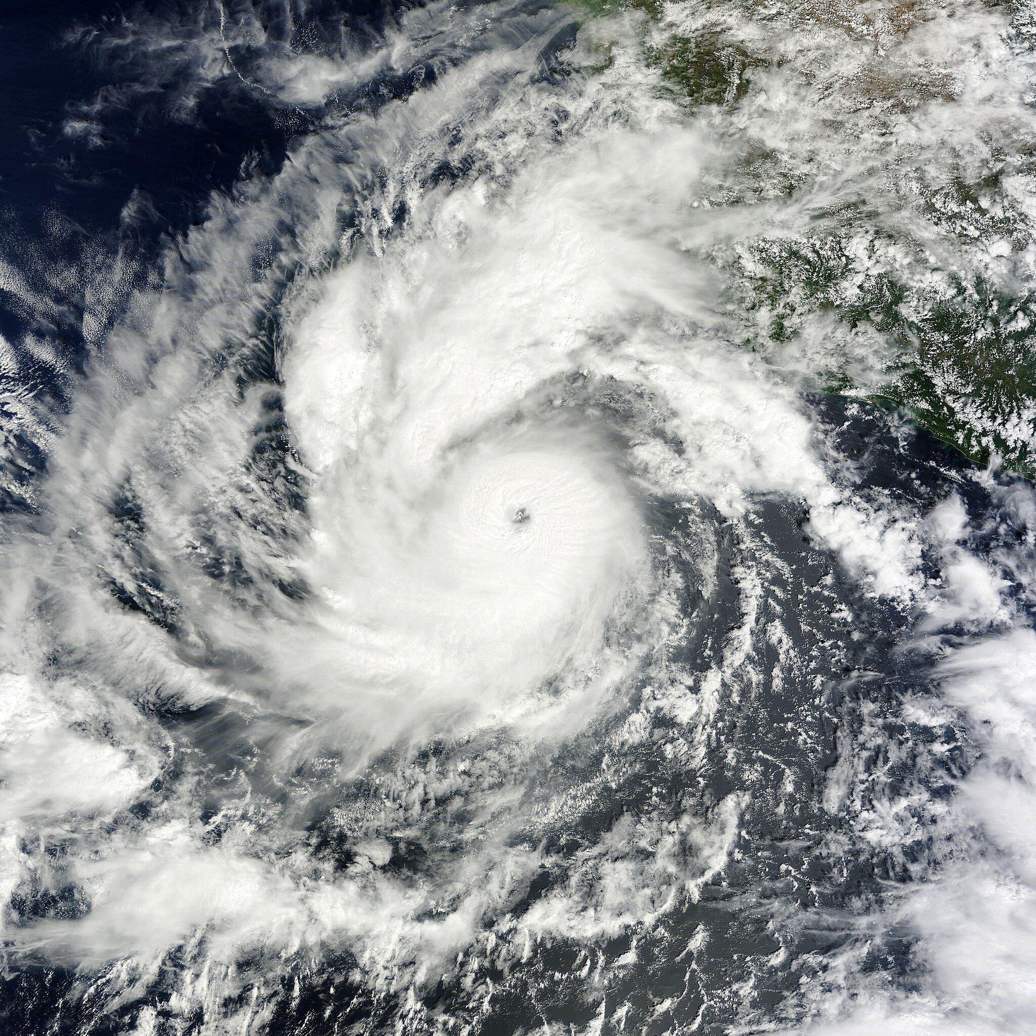
English: On October 6, 2011, a tropical depression over the eastern Pacific Ocean strengthened into Tropical Storm Jova. On October 8, it became a hurricane. By 11:00 a.m. Pacific Daylight Time (PDT) on October 10, 2011, the U.S. National Hurricane Center (NHC) reported that Jova was a Category 3 storm headed for the southwestern coast of Mexico.
The Moderate Resolution Imaging Spectroradiometer (MODIS) on NASA’s Terra satellite captured this natural-color image at 10:40 a.m. Pacific Daylight Time on October 10, 2011. Jova sports the spiral shape and distinct eye characteristic of strong storms. In the northeast quadrant, the storm’s clouds graze the coast of Mexico. As of 11:00 a.m. PDT on October 10, Jova had maximum sustained winds of 125 miles (205 kilometers) per hour, and was located roughly 220 miles (255 kilometers) southwest of Manzanillo, Mexico. A hurricane warning was in effect from Punta San Telmo north to Cabo Corrientes, and a tropical storm warning was in effect for Lazaro Cardenas north to Punta San Telmo. The NHC stated that the storm could become a Category 4 hurricane before making landfall on October 11. |
| Date | |
| Source | http://earthobservatory.nasa.gov/NaturalHazards/view.php?id=73873 |
| Author | NASA image courtesy MODIS Rapid Response Team, Goddard Space Flight Center. Caption by Michon Scott. |
Licensing
| This file is in the public domain in the United States because it was solely created by NASA. NASA copyright policy states that "NASA material is not protected by copyright unless noted". (See Template:PD-USGov, NASA copyright policy page or JPL Image Use Policy.) | ||
 |
Warnings:
|
File history
Click on a date/time to view the file as it appeared at that time.
| Date/Time | Thumbnail | Dimensions | User | Comment | |
|---|---|---|---|---|---|
| current | 21:45, 6 January 2019 | | 5,760 × 5,760 (4.18 MB) | David Levy | cropped |
| 20:59, 10 October 2011 |  | 5,760 × 6,000 (4.67 MB) | Supportstorm | {{Information |Description ={{en|1=Hurricane Jova on October 10, 2011}} |Source =http://lance-modis.eosdis.nasa.gov/wms/?zoom=5&lat=19.20117&lon=-105.74414&layers=B0000FFFFFFT&datum1=10/10/2011 |Author =NASA, MODIS Rapid Response System |
File usage
The following pages on the English Wikipedia use this file (pages on other projects are not listed):
Global file usage
The following other wikis use this file:
- Usage on de.wikipedia.org
- Usage on ko.wikipedia.org
- Usage on zh.wikipedia.org