
File:Forlorn Hope Estate, 1828.jpg

Size of this preview: 800 × 595 pixels. Other resolutions: 320 × 238 pixels | 640 × 476 pixels | 1,024 × 762 pixels | 1,280 × 953 pixels | 2,560 × 1,905 pixels | 3,765 × 2,802 pixels.
Original file (3,765 × 2,802 pixels, file size: 1.63 MB, MIME type: image/jpeg)
| This is a file from the Wikimedia Commons. Information from its description page there is shown below. Commons is a freely licensed media file repository. You can help. |
Summary
| Description |
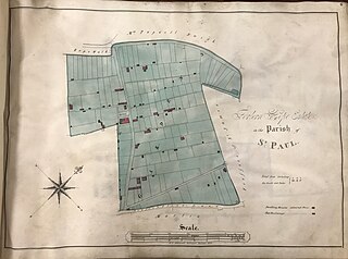
English: A plan or map of a property holding in Bristol, England, owned at the time by a charitable trust called St Nicholas Church Lands: “Volume of plans of St Nicholas Church Lands, 1828’, Bristol Archives, 39180, p. 6. |
| Date | |
| Source | https://archive.org/details/beardplague/page/27/mode/2up |
| Author | George C. Ashmead |
| Camera location | | View this and other nearby images on: OpenStreetMap |
|---|
First published in: Alex Beard (ed.), Documents Relating to the Great Plague of 1665-1666 in Bristol (Bristol Record Society electronic publication, September 2021), p. 27
Licensing
|
This work is in the public domain in its country of origin and other countries and areas where the copyright term is the author's life plus 70 years or fewer. This work is in the public domain in the United States because it was published (or registered with the U.S. Copyright Office) before January 1, 1929. | |
| This file has been identified as being free of known restrictions under copyright law, including all related and neighboring rights. | |
File history
Click on a date/time to view the file as it appeared at that time.
| Date/Time | Thumbnail | Dimensions | User | Comment | |
|---|---|---|---|---|---|
| current | 13:22, 3 June 2023 | | 3,765 × 2,802 (1.63 MB) | Evan T Jones | Uploaded a work by George C. Ashmead from https://archive.org/details/beardplague/page/27/mode/2up with UploadWizard |
File usage
The following pages on the English Wikipedia use this file (pages on other projects are not listed):