
File:CAMap-doton-San Bernardino.PNG
No higher resolution available.
CAMap-doton-San_Bernardino.PNG (209 × 230 pixels, file size: 5 KB, MIME type: image/png)
| This is a file from the Wikimedia Commons. Information from its description page there is shown below. Commons is a freely licensed media file repository. You can help. |

|
This locator map image could be re-created using vector graphics as an SVG file. This has several advantages; see Commons:Media for cleanup for more information. If an SVG form of this image is available, please upload it and afterwards replace this template with
{{vector version available|new image name}}.
It is recommended to name the SVG file “CAMap-doton-San Bernardino.svg”—then the template Vector version available (or Vva) does not need the new image name parameter. |
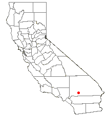
- City of San Bernardino - in San Bernardino County, California
- Locator maps U.S. cities derived from PD state maps by different users from en.wikipedia.
the filename has sometimes been adapted to the general syntax

|
Permission is granted to copy, distribute and/or modify this document under the terms of the GNU Free Documentation License, Version 1.2 or any later version published by the Free Software Foundation; with no Invariant Sections, no Front-Cover Texts, and no Back-Cover Texts. A copy of the license is included in the section entitled GNU Free Documentation License. |
| This file is licensed under the Creative Commons Attribution-Share Alike 3.0 Unported license. | ||
| ||
| This licensing tag was added to this file as part of the GFDL licensing update. |
File history
Click on a date/time to view the file as it appeared at that time.
| Date/Time | Thumbnail | Dimensions | User | Comment | |
|---|---|---|---|---|---|
| current | 16:33, 3 December 2015 | | 209 × 230 (5 KB) | Ellin Beltz | Reverted to version as of 21:53, 10 February 2006 (UTC) because whoever cleared the background ate outlines as well. |
| 21:46, 2 December 2015 |  | 209 × 230 (9 KB) | HalloweenNight | Outline | |
| 21:53, 10 February 2006 |  | 209 × 230 (5 KB) | Michiel1972 | Locator maps U.S. cities derived from PD state maps by different users from en.wikipedia. <small>the filename has sometimes been adapted to the general syntax</small> {{GFDL}} category:Location maps of U.S. cities |
File usage
The following pages on the English Wikipedia use this file (pages on other projects are not listed):
Global file usage
The following other wikis use this file:
- Usage on ar.wikipedia.org
- Usage on de.wikipedia.org
- Usage on fr.wikinews.org
- Usage on hy.wikipedia.org
- Usage on ja.wikipedia.org
- Usage on ko.wikipedia.org
- Usage on pl.wikivoyage.org
- Usage on zh.wikipedia.org