
File:Blank map of the Philippines (primary LGUs).svg

Size of this PNG preview of this SVG file: 512 × 561 pixels. Other resolutions: 219 × 240 pixels | 438 × 480 pixels | 701 × 768 pixels | 935 × 1,024 pixels | 1,869 × 2,048 pixels.
Original file (SVG file, nominally 512 × 561 pixels, file size: 1.35 MB)
| This is a file from the Wikimedia Commons. Information from its description page there is shown below. Commons is a freely licensed media file repository. You can help. |
.svg)
Summary
| Description |
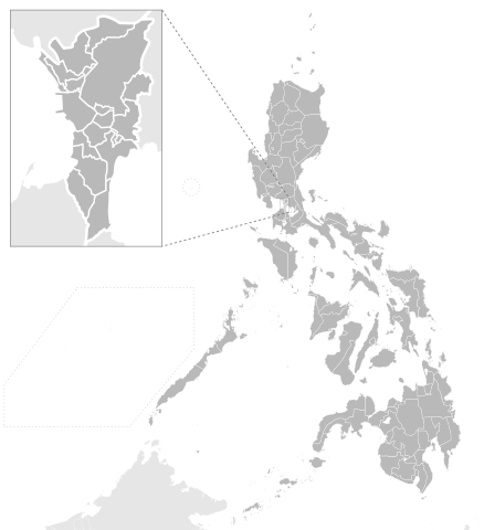
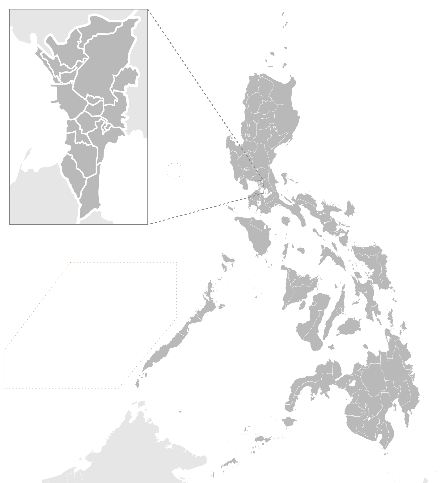
English: Map showing first-level political divisions of the Philippine Tagalog: Mapang nagpapakita ng mga pangunahing dibisyong pulitikal ng Pilipinas |
| Date | |
| Source |
This file was derived from: PH Administrative Map.svg:  |
| Author |
|
| This is a retouched picture, which means that it has been digitally altered from its original version. The original can be viewed here: PH Administrative Map.svg:
|
Licensing
I, the copyright holder of this work, hereby publish it under the following license:
This file is licensed under the Creative Commons Attribution-Share Alike 4.0 International license.
- You are free:
- to share – to copy, distribute and transmit the work
- to remix – to adapt the work
- Under the following conditions:
- attribution – You must give appropriate credit, provide a link to the license, and indicate if changes were made. You may do so in any reasonable manner, but not in any way that suggests the licensor endorses you or your use.
- share alike – If you remix, transform, or build upon the material, you must distribute your contributions under the same or compatible license as the original.
Original upload log
This image is a derivative work of the following images:
- File:PH Administrative Map.svg licensed with Cc-by-sa-4.0
- 2019-08-10T11:13:23Z Dakilang Isagani 512x561 (1737359 Bytes) minor label adjustments
- 2019-08-10T10:41:24Z Dakilang Isagani 512x561 (1737871 Bytes) Revert to original font
- 2019-08-09T17:22:35Z Dakilang Isagani 512x561 (1816841 Bytes) Formatting fixes
- 2019-08-09T16:59:41Z Dakilang Isagani 512x561 (1389698 Bytes) Fixes
- 2019-08-09T16:57:03Z Dakilang Isagani 512x561 (1313951 Bytes) formatting fix
- 2019-08-09T16:54:26Z Dakilang Isagani 512x561 (1379695 Bytes) Larger artboard size
- 2019-08-09T16:00:03Z Dakilang Isagani 512x561 (1118155 Bytes) Fixed artboard
- 2019-08-09T15:57:32Z Dakilang Isagani 512x627 (1161983 Bytes) Cleanup of map; labels fixed
- 2019-08-09T15:16:26Z Dakilang Isagani 512x561 (1121002 Bytes) User created page with UploadWizard
Uploaded with derivativeFX}}
File history
Click on a date/time to view the file as it appeared at that time.
| Date/Time | Thumbnail | Dimensions | User | Comment | |
|---|---|---|---|---|---|
| current | 14:20, 3 April 2020 | | 512 × 561 (1.35 MB) | Hariboneagle927 | == {{int:filedesc}} == {{Information |Description={{en|1=Map showing first-level political divisions of the Philippine} {{tgl|1=Mapang nagpapakita ng mga pangunahing dibisyong pulitikal ng Pilipinas}} |date=2019-08-09 |Source={{Derived from|PH Administrative Map.svg|display=50}} |Date=2020-04-03 14:19 (UTC) |Author=* File:PH Administrative Map.svg: Dakilang Isagani * derivative work: [[User:{{subst:REVISIONUSER}}|{{subst:REVISIONUS... |
File usage
No pages on the English Wikipedia use this file (pages on other projects are not listed).
.svg)