
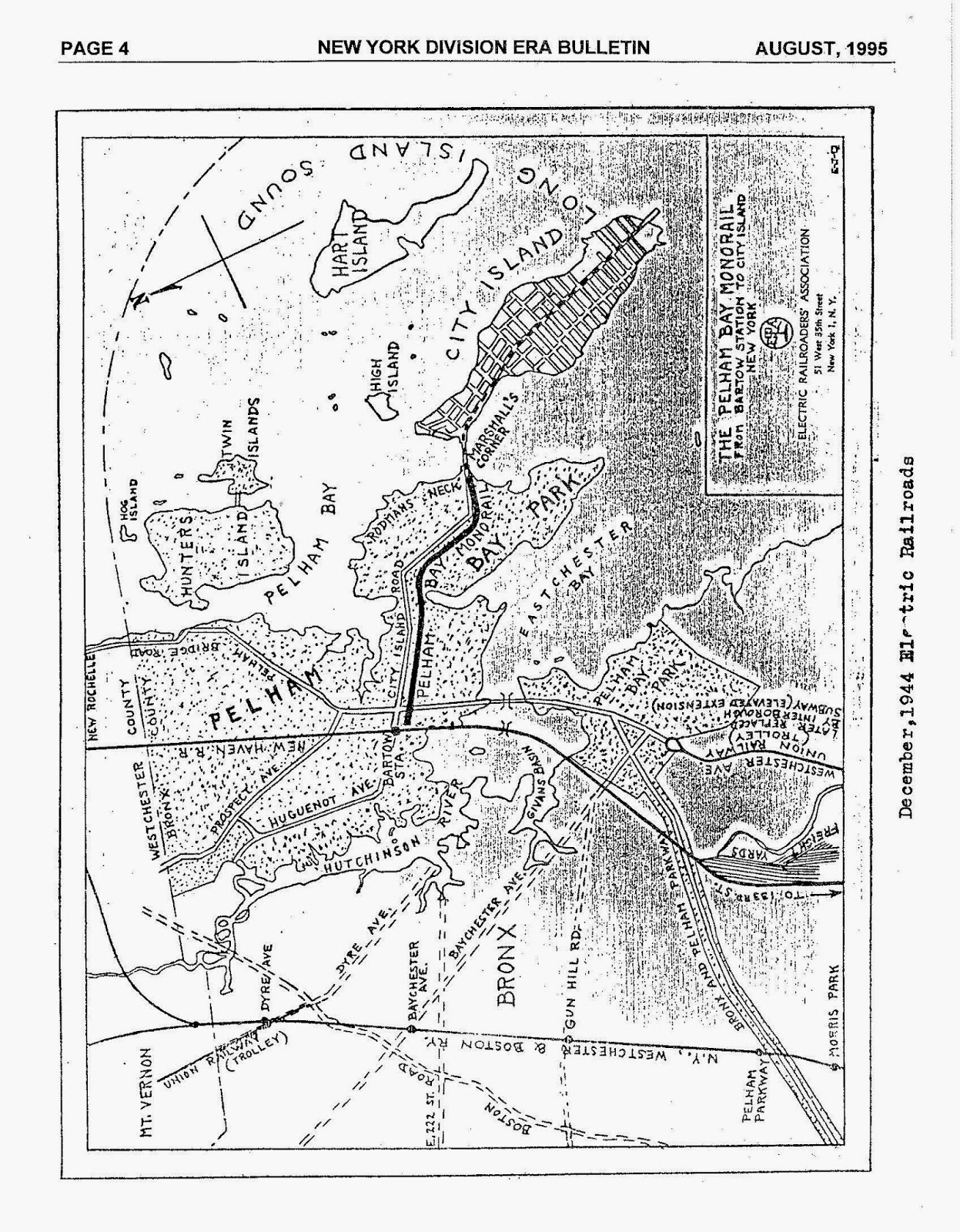
File:Approximate Route of Pelham Park and City Island Railway.png

Size of this preview: 718 × 600 pixels. Other resolutions: 288 × 240 pixels | 575 × 480 pixels | 920 × 768 pixels | 1,226 × 1,024 pixels | 2,453 × 2,048 pixels | 2,764 × 2,308 pixels.
Original file (2,764 × 2,308 pixels, file size: 2.93 MB, MIME type: image/png)
| This media file is either in the public domain or published under a free license, and contains no inbound file links. If this media file is useful, then it should be transferred to the Wikimedia Commons. If this media is not useful, then please propose it for deletion or list it at files for discussion. |
Summary[edit]
| Description |
Screenshot from https://www.openstreetmap.org/way/249029872 with overlayed data from https://3.bp.blogspot.com/-u1gjvbcBch8/Uw6ToDReCuI/AAAAAAAADB8/LP_JPWcKvyw/s1600/PELHAM_MAP.jpg | ||
|---|---|---|---|
| Source |
Open Street Map | ||
| Date |
12 September 2021 | ||
| Author |
© OpenStreetMap contributors | ||
| Permission (Reusing this file) |
Open Data Commons Open Database License (ODbL) https://www.openstreetmap.org/copyright
|
Licensing[edit]
| This work is licensed under the Creative Commons Attribution-ShareAlike 2.0 License. |
File history
Click on a date/time to view the file as it appeared at that time.
| Date/Time | Thumbnail | Dimensions | User | Comment | |
|---|---|---|---|---|---|
| current | 00:46, 13 September 2021 | | 2,764 × 2,308 (2.93 MB) | RoySmith (talk | contribs) | Uploading a file from a free published source using File Upload Wizard |
You cannot overwrite this file.
File usage
No pages on the English Wikipedia use this file (pages on other projects are not listed).