
File:Alberta Highway 13 Map.png
Size of this preview: 356 × 600 pixels. Other resolutions: 142 × 240 pixels | 557 × 938 pixels.
Original file (557 × 938 pixels, file size: 115 KB, MIME type: image/png)
| This is a file from the Wikimedia Commons. Information from its description page there is shown below. Commons is a freely licensed media file repository. You can help. |
Summary
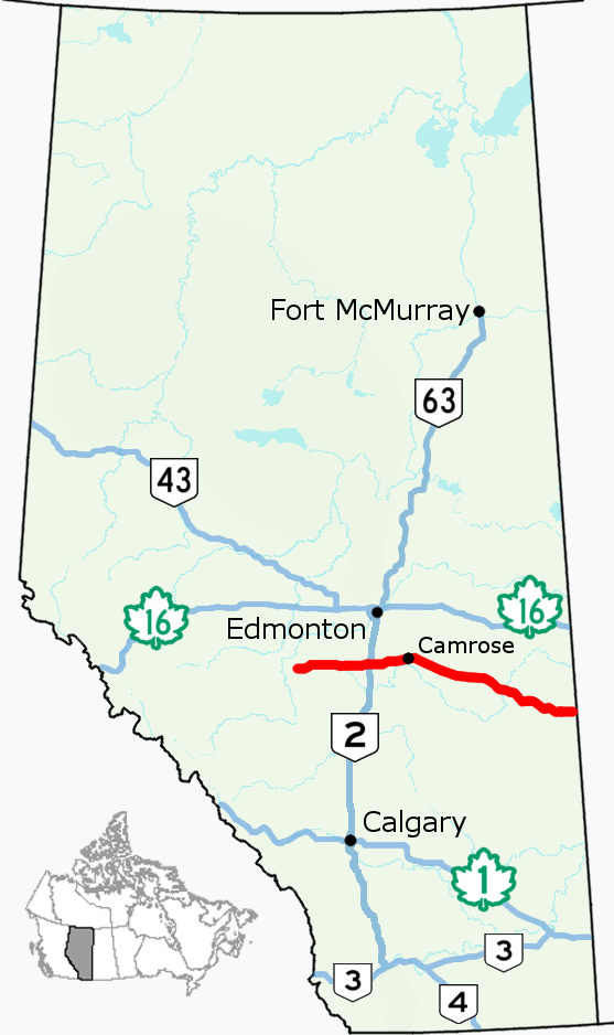
| Description | Alignment of Highway 13 in Alberta, Canada. |
| Source |
This file was derived from: Alberta Highway 002.png
|
| Author |
Licensing
I, the copyright holder of this work, hereby publish it under the following license:
This file is licensed under the Creative Commons Attribution 4.0 International license.
- You are free:
- to share – to copy, distribute and transmit the work
- to remix – to adapt the work
- Under the following conditions:
- attribution – You must give appropriate credit, provide a link to the license, and indicate if changes were made. You may do so in any reasonable manner, but not in any way that suggests the licensor endorses you or your use.
File history
Click on a date/time to view the file as it appeared at that time.
| Date/Time | Thumbnail | Dimensions | User | Comment | |
|---|---|---|---|---|---|
| current | 15:09, 6 August 2017 | | 557 × 938 (115 KB) | AceYYC | {{Information |Description=Alignment of Highway 13 in Alberta, Canada. |Source={{Derived from|File:Alberta Highway 002.png}} *Simplified and optimized by Acefitt. |Author=*Original image (CC-BY-4.0): Hwy43 *Der... |
File usage
The following pages on the English Wikipedia use this file (pages on other projects are not listed):
Global file usage
The following other wikis use this file:
- Usage on www.wikidata.org