
File:2013, The Chuckwalla Valley and Coxcomb Mountains from Old US 60-Frink-Grant Trail - panoramio.jpg

Size of this preview: 800 × 533 pixels. Other resolutions: 320 × 213 pixels | 640 × 427 pixels | 1,024 × 683 pixels | 1,280 × 853 pixels | 2,560 × 1,707 pixels | 6,000 × 4,000 pixels.
Original file (6,000 × 4,000 pixels, file size: 6.16 MB, MIME type: image/jpeg)
| This is a file from the Wikimedia Commons. Information from its description page there is shown below. Commons is a freely licensed media file repository. You can help. |
Summary
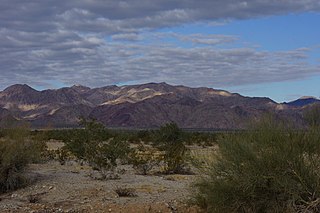
| Description | 2013, The Chuckwalla Valley and Coxcomb Mountains from Old US 60/Frink-Grant Trail | ||
| Date | Taken on 5 December 2013 | ||
| Source | https://web.archive.org/web/20161028005659/http://www.panoramio.com/photo/100956037 | ||
| Author | Chris English | ||
| Permission (Reusing this file) |
This file is licensed under the Creative Commons Attribution-Share Alike 3.0 Unported license. Attribution: Chris English
|
||
| Tags (from Panoramio photo page) | Riverside County, 2013, California, Chuckwalla Valley, Coxcomb Mountains, Desert Center, Ragsdale Road, Riverside County, U.S. 60, United States |
| Camera location | | View this and other nearby images on: OpenStreetMap |
|---|

|
The categories of this image need checking. You can do so here.
|
File history
Click on a date/time to view the file as it appeared at that time.
| Date/Time | Thumbnail | Dimensions | User | Comment | |
|---|---|---|---|---|---|
| current | 02:01, 11 March 2017 | | 6,000 × 4,000 (6.16 MB) | Panoramio upload bot | == {{int:filedesc}} == {{Information |description=2013, The Chuckwalla Valley and Coxcomb Mountains from Old US 60/Frink-Grant Trail |date={{Taken on|2013-12-05}} |source=http://www.panoramio.com/photo/100956037 |author=[http://www.panoramio.com/user/4... |
File usage
The following pages on the English Wikipedia use this file (pages on other projects are not listed):
Global file usage
The following other wikis use this file:
- Usage on arz.wikipedia.org
- Usage on ceb.wikipedia.org
- Usage on lld.wikipedia.org
- Usage on www.wikidata.org